
Drone geography (Geography of drones) is a geographical discipline that deals with the study of certain methods of recording a space (terrain), using drones and remote aerial photography. Drones are unmanned aerial vehicles that can fly in the air using a pre-programmed flight plan or using complex autonomous dynamic systems. They are different from each other in their function, type, size, price, quality and ways of recording a certain terrain, but also in the use itself. The basis of drone geography research is: geographical location of countries in the world that have the largest use of drones in geography and other geosciences, types and methods of using drones and microdrones in practical (field), scientific and school geography, as well as the use of georeferencing, location (GPS) and maps geospatial visualizations of certain phenomena and processes that are recorded from the air. Drones that are used exclusively in geography and other geosciences are called geodrons. Drone geography is a part of geospatial technologies and as such has a great connection with all geographical disciplines that deal with data collection and recording a certain part of the terrain or landscape from the air, with the aim of creating certain types of profiles in the field or as a visual map. It’s not a part of cartography and topography, but it’s very connected with these sciences, and has great application in geography.
The development of drone geography was preceded by different ways of shooting a certain terrain from the air, and the first aerial image was made by Felix Tournachon (1858) in a closed balloon above the city of Paris. This image marked the beginning of innovation (20th century) in aerial photogrammetry and satellite imaging of certain phenomena on planet Earth and in space. Since the beginning of the 21st century, the use of drones in the world is constantly increasing, and their application in geography is multiple and the number of geographers and specialists in geospatial technologies, who are interested in this type of aircraft, is constantly increasing. If we compare service providers, export, import, and application of drones in scientific research and military, top countries in using drones in the world are: United States, Japan, United Kingdom, Canada, India, Russia, Malaysia, Israel, China, and Italy. High impact of using drones is also available in countries like: France, Spain, Brazil, Australia, United Arab Emirates, Turkey, Egypt, Iran, Indonesia, Switzerland, Germany, and South Africa.
Application of drones and microdrones in geosciences and geographical scientific research
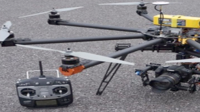
Drones or unmanned aerial vehicles (UAVs) are increasingly used as a way to collect geospatial data in geography and a number of geographic disciplines, as well as other related sciences. The most widely used drone surveys are: aerial photogrammetry, geodesy, cartography, geology, geomorphology, meteorology, hydrography, biogeography, geoecology, geophysics, archeology, human, population, urban, military, economic, agricultural, photographic, travel, tourist and traffic geography. Photos taken from the air and with the help of videos can give a complete view of a map. This virtual way of capturing the terrain and 3D analysis, for each drone user is a complete experience in the form of a photographic display. Recording of a certain terrain is also done on the basis of a given location, and with the help of coordinates (georeferencing).
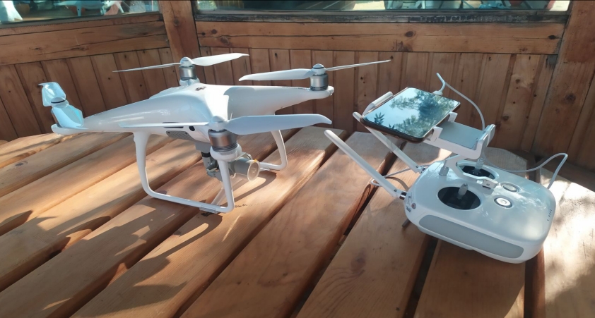
The use of drones in schools and scientific institutions around the world, provides interesting opportunities for practical application of the learned and visual experience of certain phenomena and processes in nature and around us. The use of drones and microdrones of different sizes is multiple, and they are most often used in: rapid surveying of landscapes, parts of the coast or river, to record changes in vegetation and relief over a period of time, as well as to collect data for some parameters in urban and rural areas, military, geopolitical and gestural purposes, and as a form of entertainment and hobby.
Drones can be used in scientific research and observations, along with the use of photographs, maps and videos. Today, they form the basis of a more detailed field work, and the results obtained are of great importance as a basis for collecting data on a given area or landscape. In the last 10 years, great attention in the use of drones has been given to rules and laws that differ in certain countries of the world, but there are also frequent discussions about ethical and legal issues about the ways and methods of using drones.
Possibilities of introducing drone geography as a special geographical discipline and an independent subject at universities
Given the growing popularity and application of drones in geosciences and in everyday life, it is necessary to have independent directions in high schools and colleges around the world. Numerous scientific institutions and research institutes already have their own teams formed that are exclusively dedicated to drones and the possibilities of their application. However, universities around the world still lack independent subjects or departments dedicated to the application of drones in geosciences. Today, drone geography is almost non-existent as an independent subject in the departments of Geography, and most geographers don’t know how to define this geographical discipline or don’t know all the possibilities of its application in schools, field work and scientific geography.
Here is what the proposed curriculum for the introduction of the subject of geography of drones would look like. It is a curriculum for the certain departments of geography within higher education institutions around the world. Such a program should be accompanied by adequate technological equipment, but also staff that is trained for theoretical teaching and practical application of drones in geographical research.
Geography of drones (Drone geography)-curriculum suggestion:
- Geography of drones-definition and significance in geographical science
- Historical development of aerial imaging devices, and the emergence of satellite imagery on the planet Earth and in space
- Models and types of unmanned aerial vehicles (UAV)
- Production of drones and their accessibility on the world market
- Possibilities of application of drones in geographical disciplines and other geosciences
- Databases and data models, analytical development and 3D geographic analysis of object-based images
- Rules and laws in using drones by countries around the world
- Ethics about drone use in the world
- Application of drones in schools in the subject of geography
- Practical application of drones in geographical and field research
Progress in geographical science and scientific research is not possible if the constant development of technologies and their wider application in geography are not followed. The future of scientific research and geographical science are in drones and satellite imagery of the planet Earth and space. The introduction of drone geography (geography of drones) as an independent geographical discipline or subject and its application in the departments of geography around the world is an indicator that geographical science and geospatial technologies form the basis of science in the world.
Reproduction of this text in any way and in any volume is not allowed without the consent of the author of the text (paper). Unauthorized use and use of any kind is a criminal offense/ALL RIGHTS RESERVED
Text avaliable for MundoGEO