While professional drones are commonly used today in land surveying and GIS applications, it is unusual to see UAVs employed on construction sites for highly accurate survey work. However thanks to the accuracy reported in a new senseFly white paper published in September 2015, this looks set to change.
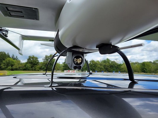
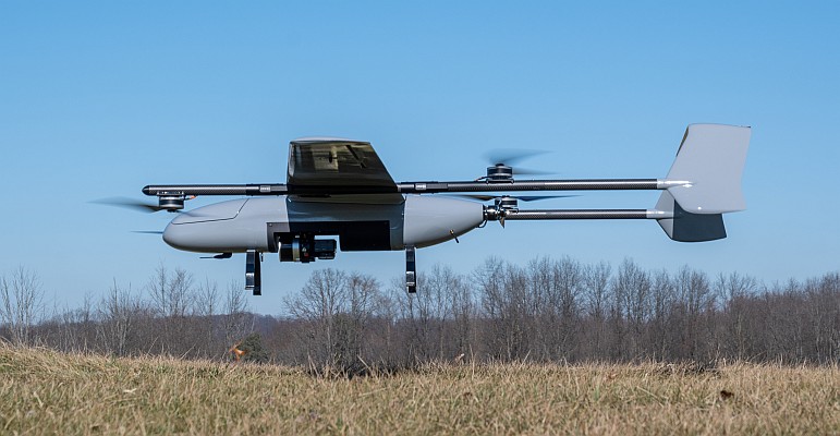
The white paper, named Generating highly accurate 3D data using a senseFly eXom drone, presents the results of two photogrammetric land surveys of a construction site. The project was completed earlier this month (September, 2015) using two senseFly eXom close mapping and inspection drones.
The results demonstrate that 3D point clouds produced with an eXom quadcopter can reach a global precision comparable to that of a total station survey and, as such, meet the typical accuracy requirements of construction projects.
The accuracy results of the two surveys were within planimetry and altimetry expectations. The first eXom survey (figure 8 of the white paper) achieved 2.1 mm accuracy in X, 1.9 mm in Y and 0.1 mm in Z (RMSE). The second eXom survey (figure 9 of the white paper) achieved 0.8 mm (X), 0.5 mm (Y) and 4.2 mm (Z).
This degree of absolute accuracy from a drone is unparalleled and positions the eXom as a surveying instrument that is comparable in performance to standard total stations, said Andrea Halter, senseFly’s co-founder. These results were due, in part, to the high 38MP resolution and sharpness of the flight’s images, captured by the main camera inside eXom’s TripleView head. Add to this image quality the ability to operate close to the terrain and the introduction of highly precise ground controls and you have a recipe for exceptionally accurate 3D data, she further explained.
To download the eXom accuracy white paper, see here.
Source: GIM International