The Capturing Reality Forum (CRF) has launched a fast-paced, informative and rewarding conference programme of nearly 50 groundbreaking papers to be presented by industry leaders from across the globe. Formed by combining the best of SPAR Europe and ELMF into a single event, Capturing Reality Forum focuses on the technologies of laser scanning, LiDAR, 3D data capture and modelling, to bring inspiration and growth to this rapidly developing industry. The Forum takes place at the Salzburg Congress in Salzburg, Austria, from 23-25 November 2015.
The conference committee are delighted to report a staggering response to its call for papers. The committee received over 110 abstracts from industry leaders across the globe. Alastair MacDonald, Conference Chairman, explains, “This programme promises to be the best yet in my 15 years of being involved with the CRF and its predecessors, the ILMF/ELMF and SPAR Europe. The quality of information to be presented is world class, with many exciting new developments and systems being announced for the
first time across a range of key sectors in the geospatial data capture, visualisation and imaging industry. There is truly much for all professionals to learn at CRF15.”
With so much support from the industry, the conference programme covers a wide range of topics important to the capturing, visualisation and management of detailed 3D imagery and asset data. The programme examines how 3D, laser scanning and imagery data capture can help improve the quality of available and newly captured digital information on existing assets to deliver freedom of choice to all asset stakeholders to maximise operational efficiency and reduce error and safety risks.
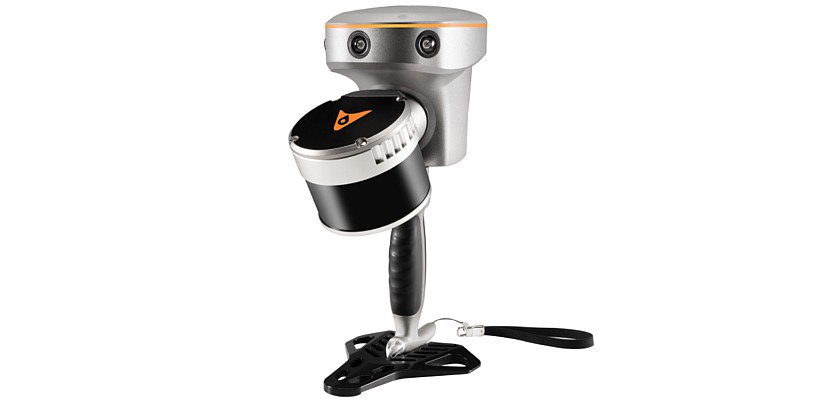
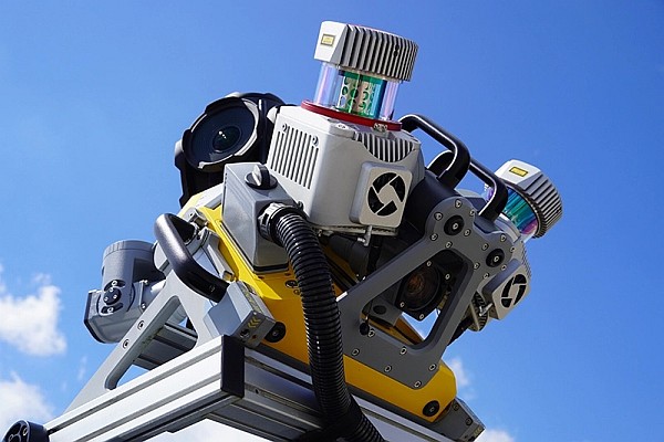
Three days of technical papers include discussion on: capturing data on a big data level, potentially useful for reconstruction of structures that may be lost or damaged through natural causes, terrorism or retrospective reconstruction of structures that no longer exist; details of an innovative terrestrial and handheld data fusion approach for reality capture purposes; the potential from using 4D LiDAR data analysis as a natural extension of current technology; and the deployment of cutting-edge technology sUAVs (small Unmanned Aerial Systems) to perform large, country size airborne LiDAR collection programmes and capture vertical structures such as rock faces.
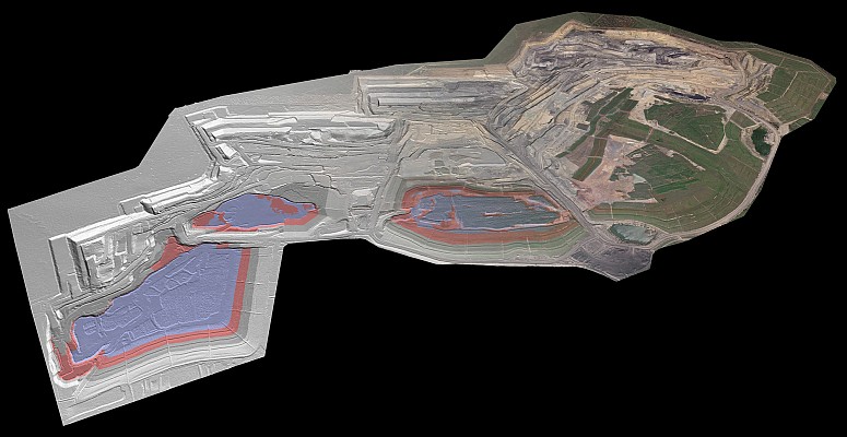
Of particular interest to natural resource data users will be papers examining the efficiency and value of multispectral LiDAR for forest mapping, accessing waveform LiDAR to support in-depth analysis of forest canopy characteristics. The topic of airborne laser bathymetry, the precise mapping of water surface levels addresses issues in flood hazard mapping, habitat modelling and hydraulic engineering. Also presented are new applications that have huge positive business implications for automated stockpile measurement.
A growing segment within the mapping industry is the availability of free and open-source web massive point cloud visualisation technologies. This key topic is covered in a number of papers at national and state levels. This leads to an emerging area of point cloud management – the provision and streaming of very large data sets from relational databases. The conference will be the first to hear about a unique and highly innovative open-source LiDAR quality control programme development.
Other exciting new developments include Geo-Simulation systems that integrate geo information systems, virtual reality rendering, simulation technology and haptic feedback to form a geo-simulation system which is also a virtual test bed for real world applications. In the built environment, papers will examine just how BIM will develop as a ‘small but important’ cog in the bigger machine of Smart Cities and how geo-technology will enable developing world cities to deal with rapid urbanisation. Of special interest is the paper describing how using geospatial data can create photo-realistic environments using video game rendering technologies. A key objective of this year’s conference programme is to focus on what can be done with the data for the end-users, not just examine how the data was captured. The Capturing Reality Forum will be supported by an exhibition of 40 stands displaying the world’s leading manufacturers, software developers and service providers of 3D imaging, laser scanning and LiDAR products. As an extra benefit to delegates, many of the exhexhibiting companies will host workshops; providing an opportunity for further discussion of technology.
Another highlight of the event is the venue itself in the historic setting of Salzburg, which is easily accessible with its location at the centre of Europe, and coincides with Salzburg’s renowned Christmas markets. This, in combination with a cutting-edge conference programme, promises an event with the ideal balance of technology, social networking and leisure. Please visit: www.CapturingRealityForum.com for full details about the conference and opportunities for exhibiting at the launch event which runs from 23-25 November
2015