
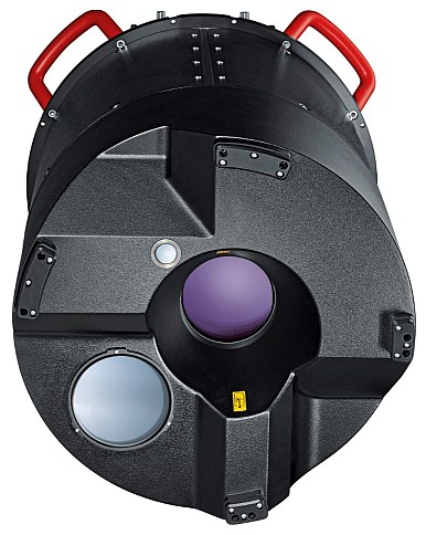
Leica Geosystems announced the launch of TerrainMapper, its next generation linear mode LiDAR system. As part of the RealTerrain airborne LiDAR mapping solution, the new sensor builds on Leica Geosystems sensor technology and is supported by the HxMap unified multi-sensor post-processing workflow.
TerrainMapper enables users to increase point accuracy, deliver even point density across the swath, and accommodates more efficient flight planning in complex terrain such as those encountered in urban spaces and mountainous areas. The newest sensor increases both acquisition speed and processing productivity, providing efficiency and precision for any project.
Be efficient
The TerrainMapper increases data collection efficiency up to 2Mhz measurement rate while operating with gateless Multiple Pulses in the Air (MPiA). Flying heights of 300 to 5,000 metres and adjustable field of view gives users the flexibility to fly higher for larger swath width or lower for ultra-high point density. A built-in camera collects information for point cloud colourisation with co-registered 3- or 4-band options.
TerrainMapper delivers United States Geological Survey (USCS) Quality Level 0 data at up to 500 square kilometres per hour collection rates. The 5 cm accuracy, even at higher flying heights, offers a major efficiency improvement for complex and changing terrain.
Through the integration of LiDAR processing in the proven HxMap multi-sensor high-performance workflow, users can now process, calibrate and register LiDAR point clouds while simultaneously processing auxiliary image sensor data and colourising the point cloud, increasing overall workflow productivity. With its unique distributed processing capability, processing speed can be scaled to customer needs, growing with their business.
“Having customer satisfaction as our No. 1 priority, we focus on delivering reliable solutions that exceed expectations. The TerrainMapper is our latest innovation and brings unprecedented productivity to our customers’ projects,” said Anders Ekelund, Leica Geosystems vice president for Airborne LiDAR. “With improved accuracy, increased productivity of the workflow and the higheset data collection rate, we give airborne system users a competitive advantage in their business.”
For more information about the TerrainMapper, please visit https://leica-geosystems.com/products/airborne-systems/lidar-sensors/leica-terrainmapper


