
The 2018 version provides up-to-date and accurate data available.
New U.S. Data
The updated streets allow for accurate address locating and street visualization, directions, drive-time rings, and drive-time territories.
Maptitude 2018 users will have access to completely new business critical data. The boundaries (e.g., ZIP Codes, Counties, States) have updated demographics and Census data such as buying power/disposable income, banking compliance data, and 2016 Census ACS data. Now included are four new fields covering the growth in income and population, and daytime population counts.
Maptitude 2018 also ships with the January 2018 ZIP Code release, ensuring that you are using the latest nationwide postal data.
 Enhanced Data Import
Data linking was one of the features of Microsoft MapPoint and has been added to Maptitude 2018! Maptitude 2018 allows you to update your map with any changes made to your data source. For example, if you have added/deleted/changed customer records in an Excel spreadsheet, you can simply choose to update your Maptitude map layer with the latest information and locations.
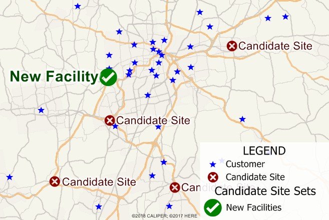
Enhanced Results
You can create drive-time zone reports using the labels/names of your stores and customers. This allows you to create multiple travel rings around multiple locations and still be able to identify the location for each ring.
The Wizard driven interface walks you through adding shaded boundaries to an existing map, such as adding sales by ZIP Code to a customer map. Create-a-Map Wizard also automatically creates reports when demographics are chosen. All reports include the new data on income growth, population growth, and daytime population.
You can also create 3-D themes on two fields rather than just one; and can create travel time or distance tables between ZIP Codes or any other area layer.
Learn more at: www.caliper.com/press/pr20180222-maptitude-2018.htm


