SimActive Inc., a world-leading developer of photogrammetry software, announces the use of its Correlator3D product by the US Army Corps of Engineers for corridor mapping. The software is used to process imagery and create mapping products in conjunction with topo-bathy lidar systems.
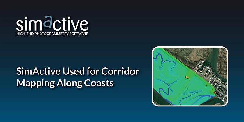
As part of the Corps of Engineers, the Joint Airborne Lidar Bathymetry Technical Center of Expertise (JALBTCX) uses the most advanced sensors to map US coastal shorelines. In combination with topo-bathy lidar, imagery is collected with a Phase One 150MP camera. Surfaces are generated from the lidar data and imported into Correlator 3D along with the imagery to rapidly produce blocks of orthomosaics used for all types of assessments.
“Correlator3D is by far the easiest to use and fastest image processing software out there”, said J. Heath Harwood, Physical Scientist at the US Army Corps of Engineers. “Its DEM editing and mosaic editing tools are outstanding.”
About JALBTCX
The mission of the Joint Airborne Lidar Bathymetry Technical Center of Expertise is to perform operation, research, and development in airborne lidar bathymetry and complementary technologies to support coastal mapping and charting requirements of the US Army Corps of Engineers (USACE), the US Naval Meteorology and Oceanography Command, the National Oceanic and Atmospheric Administration (NOAA), and the US Geologic Survey (USGS). For more information, visit www.sam.usace.army.mil/Missions/Spatial-Data-Branch/JALBTCX.
About SimActive
SimActive is the developer of Correlator3D™ software, a patented end-to-end photogrammetry solution for the generation of high-quality geospatial data from satellite and aerial imagery, including drones. Correlator3D™ performs aerial triangulation (AT) and produces dense digital surface models (DSM), digital terrain models (DTM), point clouds, orthomosaics, 3D models and vectorized 3D features. Powered by GPU technology and multi-core CPUs, Correlator3D™ ensures matchless processing speed to support rapid production of large datasets. SimActive has been selling Correlator3D™ to leading mapping firms and government organizations around the world, offering cutting-edge photogrammetry software backed by exceptional customer support. For more information, visit www.simactive.com.