UP42 announced their partnership with NV5, a leading provider of LiDAR (Light Detection and Ranging) data based in Florida.
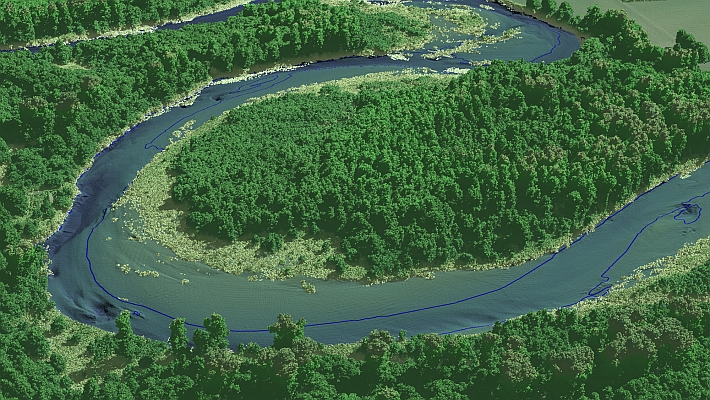
LiDAR is a form of geospatial data collection in which sensors send out laser pulses and collect the returned signals to form point clouds, where every point contains data including longitude, latitude, and elevation. NV5 is UP42’s first LiDAR provider partner.
Among other applications, NV5 LiDAR data is ideal for vegetation management and infrastructure monitoring projects, with tasking available for long corridors, transmission and distribution networks, and local grids. LiDAR point clouds give information on distances between tree foliage and power lines, reducing the need for in-person manual surveying.
LiDAR data brings value to a huge variety of use cases. For example, in architecture, engineering, and construction, it can be used during site planning stages to create detailed point clouds and Digital Terrain Models. When used to monitor sites over time, users can analyze ground and slope stability and detect surface subsidence to prevent danger. LiDAR data is also useful for building digital twin foundations.
As LiDAR data isn’t reliant on sunlight, it can be collected at any time of day or night. NV5 data has an accuracy of 10 cm (vertical) and 30 cm (horizontal), and can complement classic photogrammetry methods. LiDAR data from NV5 can now be collected on demand over Canada and the United States.
Source: UP42
MundoGEO organizes the DroneShow, MundoGEO Connect, SpaceBR Show and Expo eVTOL exhibitions annually in São Paulo, Brazil. See the highlights of the last edition: