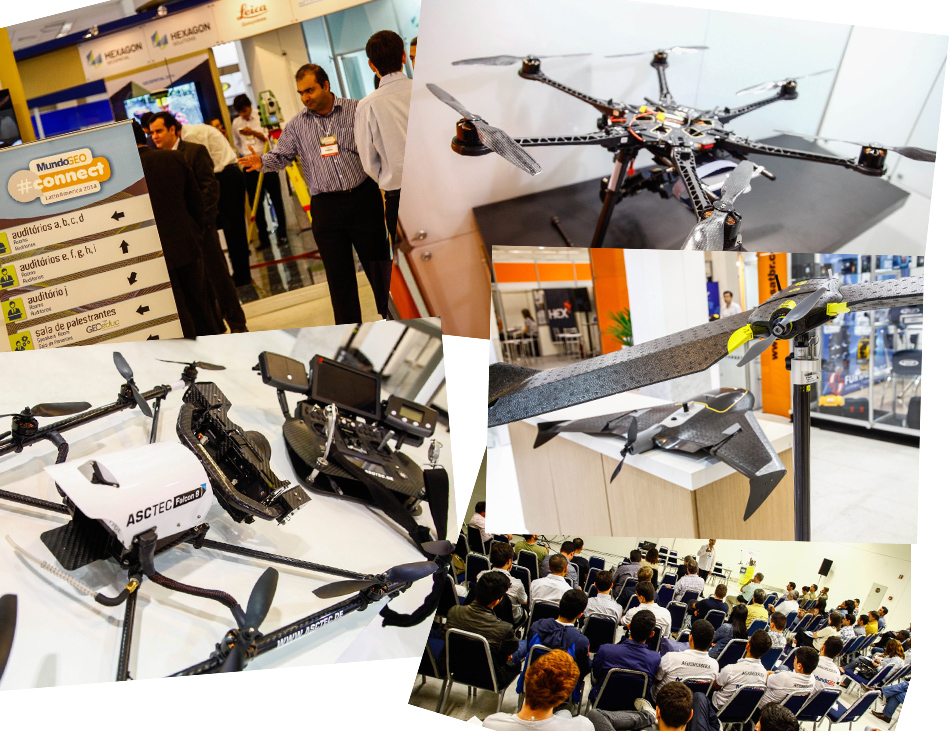
Drones for mapping is already a reality. Sector regulation will boost the use of this technology
Currently the Unmanned Aerial Vehicles (UAVs or drones) are responsible for the expansion and development of the global aerospace industry, with estimates of major investments, leaving the current $ 2.7 billion per year to about 8.3 billion in the coming years. The possibilities are enormous and, with the regulation of the sector in Brazil and many other countries, the civil use of this technology will experience amazing outcomes.
Aerial Vehicles Unmanned Systems (Sys UAVs) to obtain aerial images for various applications is a reality. The expression “Sys UAV” is used because this is a system developed to operate an unmanned aircraft efficiently and safely.
There are numerous UAVs options available, with various shapes, sizes and prices. But how can we realize which Drone is the best for each application? A good start is to determine the type of work to be done with the Sys UAV, what kind of land will be covered, what are the conditions for takeoff and landing the aircraft, areas of the size to be imaged, the ease or difficulty of access to these areas, if the use of geo-referenced images with great accuracy is required or just whether a particular area is being deforested, invaded, or if its occupation is being expanded. These factors will directly impact the flight time needed to complete each mission, and this can help to define the range and endurance that the Sys UAV should have. With this first information, it is possible to eliminate a portion of the existing systems on the market.
Unmanned aerial vehicles (UAVs or drones) and their systems will be discussed during MundoGEO#Connect 2015 conference. Experts will present the most advanced and up-to-date techniques of Drones for various applications, and also capabilities, limitations and models of this technology, as well as an overview of the current legislation.
To stay on top of this technology, participate in UAVs & Drones: Models, Uses and Limits course on 6 May, and also UAV & Drones Forum: Applications and Results, on 7 May. The program of the activities is now available. Both will be held during MundoGEO#Connect LatinAmerica, in São Paulo.
The courses, seminars and forums of MundoGEO#Connect 2015 will be held 5-7 May. You can attend one or more courses, and also check out the latest and best geospatial technologies in the seminars, forums and showcases!
With many Drones on the exhibition, the trade fair will have free access through previous registration. For more information, please contact us by email: connect@mundogeo.com or phones: (41) 3338-7789 / (11) 4063-8848.
In 2015 MundoGEO#Connect will be based on “Creating New Dimensions” mais theme. The conference will focus on promoting discussions among speakers, experts, trainers and attendees of courses, seminars and forums so that users and the community will be able to make the most of their resources and get a quick return of their investment in geospatial solutions.
For a sustainable growth of the geospatial industry it is essential to promote investments in quality aiming to increase ng productivity, because in times of economic crisis, resources need to be applied with great care and intelligence in order to generate better results.
Visit MundoGEO#Connect LatinAmerica 2015 website, check out the conference program and stay on top of the main highlights: https://mundogeoconnect.com. For further information, please contact us by email: connect@mundogeo.com, or phone: +55 41 3338-7789 / +55 11 4063-8848. For exhibitor information, get in touch with comercial@mundogeo.com.
Source: MundoGEO#Connect 2015


