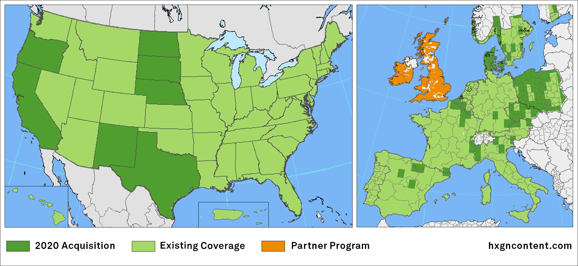
Geospatial Technologies
Phase One Introduces Next-Generation Aerial Systems: PAS 280 & PAS 150
aerial
Geoprocessing and GIS
Track’Air and Lead’Air announces new mapping camera compatible with drone
Geoprocessing and GIS
Insight from Satellite Imagery helps oil and gas companies
Editorials
Webinar Schedule