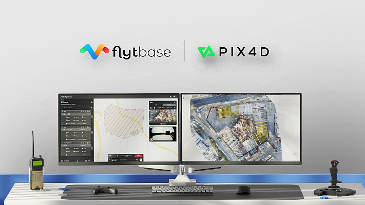
FlytBase, the leading drone autonomy software platform, announces a strategic partnership with Pix4D, the leading photogrammetry platform for terrestrial and drone mapping.
This integration will enable FlytBase users to seamlessly upload their drone-captured data directly to the online platform PIX4Dcloud, streamlining project management and minimizing manual interventions.
Mapping the Way Ahead to Seamless Data Processing
As the adoption of automated drone-docked operations increases, so does the frequency and volume of data collection. Operators can now carry out numerous daily missions and even schedule them in advance from their remote command centers. However, currently, they need to plan and execute docked flight operations on one platform, manually sort through the captured data, and then upload it to a separate data processing application to create accurate maps and 3D models. This process results in inefficiencies, increases operational complexity, and is prone to operator errors.
With the introduction of FlytBase’s Pix4D Flink, users can now directly sync their drone-captured data from FlytBase to PIX4Dcloud, an online platform for drone mapping, progress tracking, and site documentation. PIX4Dcloud processes high-resolution images using photogrammetry algorithms, transforming them into accurate, georeferenced orthomosaics, 3D meshes, point clouds, and elevation models. Widely used across various industries, Pix4D’s advanced photogrammetry platform supports applications such as construction monitoring, mapping, and surveying.
In addition to the one-click integration, FlytBase provides the latest automation functionalities required for docked drone operations, combined with flight safety and fleet management capabilities. It enables users to execute reliable, consistente drone data collection operations while seamlessly integrating with beyond visual line-of-sight (BVLOS) hardware and software solutions, such as parachutes, detect-and-avoid systems, uncrewed traffic management, and weather monitoring systems for safe operations.
Adhering to ISO 27001, SOC 2 Type II, and GDPR standards, FlytBase ensures top-tier data protection via network firewalls and offers flexible deployment options to accommodate enterprise data privacy requirements.
“The integration of FlytBase and Pix4D addresses long-standing operational challenges in the drone industry by consolidating mission planning, data collection, processing, and analysis into a cohesive, end-to-end solution,”
said Nitin Gupta, CEO & Founder of FlytBase.
“Efficient drone monitoring of enterprise assets and construction projects has never been easier, thanks to the one-click integration of Pix4D’s photogrammetry technology and FlytBase’s drone autonomy platform. This seamless workflow will automatically deliver the data you need to make the right decisions to deliver the best outcomes,”
Jeff Muller, Director of Platform at Pix4D
Join FlytBase and Pix4D for their latest webinar, titled ‘Automating 3D Data Acquisition & Processing in Construction with Drone Docks’ on the 14th of August at 10:00 AM CT (15:00 GMT). Registration link: https://flyt.link/docks-for-construction-mapping.