Nestled on the Uganda-DR Congo border, the Rwenzori Mountains—a UNESCO World Heritage site—are home to some of the world’s last tropical glaciers.
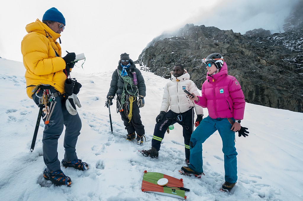
Project Pressure, in collaboration with UNESCO and the Uganda Wildlife Authority, led a groundbreaking expedition to the Rwenzori surveying all three mountains (Stanley, Baker, Speke) to create the first-ever 3D model of Mt. Stanley’s glaciers and install long-term monitoring equipment.
The team returned with critical mapping data, scientific measurements, and comparative imagery—with a stark warning about the future.
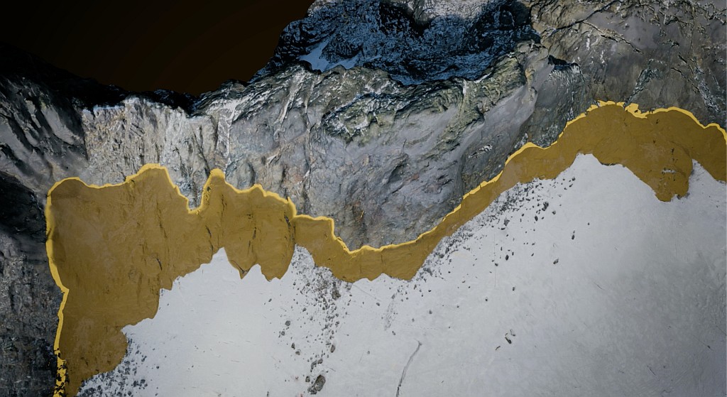
Findings show that Mt. Speke and Mt. Baker have lost their glaciers, while the surface of the Stanley Plateau Glacier has decreased by 29.5% since 2020 and is undergoing severe fragmentation. This highlights the rapid ice loss in East Africa, with profound consequences for climate science and spiritual heritage.
Beyond the science, the loss is deeply cultural. For the Bakonzo people, the glaciers are sacred, believed to be home to their god, Kithasamba. The glaciers’ disappearance signals not just an environmental crisis, but the erosion of an irreplaceable cultural heritage.
Led by Klaus Thymann, the mapping project builds on over a decade of his glaciological work, incorporating data from his expeditions in 2012, 2020, 2022, and 2024. It represents the most comprehensive record of the region’s glacial decline.
Findings
Finding – Mt. Speke
● There is no longer a glacier on Mt.Speke.
● Although there is ice, the ice does not exhibit movement and does not deform under its own weight.
Finding – Mt. Baker
● There is no longer a glacier on Mt. Baker.
● This was already observed in 2022; Mt. Baker is now practically ice-free.
Findings – Mt. Stanley
● The Mt. Stanley glaciers are becoming fragmented. The plateau and the glaciated part of Mt. Stanley’s peak, Margarita Peak, split in 2015.
● From 2020 to 2024 the surface area of Stanley Plateau glacier has reduced by 29.5%.
● From 2022 to 2024 the Stanley glacier has dropped by eight meters by the side.
● The current melting point is now mostly, if not all, above the plateau.
The Rwenzori mountains have three main peaks, Mt. Stanley, Mt. Baker and Mt. Speke. The ice on Rwenzori is the highest and most permanent source of the River Nile and constitutes significant water catchment areas in Uganda—relied upon by five million people.
The Project Pressure team confirmed that the glaciers on Mt. Baker and Mt. Speke have now disappeared. The highest peak, the top of Mt. Stanley reaches 5,109 metres (16,762 ft), and the upper regions are still glaciated, but the ice is melting at alarming rates and will likely disappear in our lifetime.
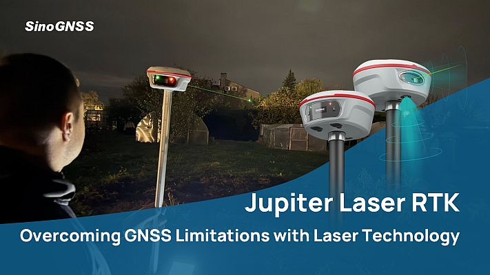
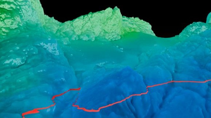
To learn more, the team led by Klaus Thymann used Trimble geospatial technologies to create the first 3D model of the last remaining glacier on the Stanley Plateau. In particular, the small, lightweight, and easy-to-use Trimble® Catalyst™ GNSS positioning service was key to success.
GNSS accesses multiple satellite systems to deliver high-precision points—essential for this complex environment. With the technologies provided by Trimble, precise geolocation points were installed and data was captured at multiple sites—providing the foundational data that underpins the entire 3D photogrammetry model.
This solution was critical in anchoring the high-resolution drone imagery to exact coordinates. Over several days, more than 850 images were captured, including all geolocation points, ensuring the model’s spatial accuracy.
Despite challenging mountain conditions, the data collection was successful with support from Solomon Kule and Muhindo Rogers. These are the first high-precision 3D glacier models in the region.
To deepen the research, Dr. Heïdi Sevestre conducted ground-penetrating radar surveys of the ice and bedrock—also a first here—with analysis led by Andrea Blindenbacher’s team in Switzerland.
For the Rwenzori’s Bakonzo people, loss of the ice has enormous cultural implications. The Bakonzo hold deep spiritual beliefs that are intricately connected to the natural landscape, particularly the snow-capped peaks. A central belief is that their gods, Kithasamba and Nyabibuya, reside in the ice of Rwenzori. For centuries, this spiritual connection has influenced how the Bakonzo interact with their environment, reinforcing conservation efforts and sustainable use of natural resources, long before colonial or modern times.
So, what’s next for the glaciers of the Rwenzori Mountains? As the ice retreats, Project Pressure continues to work with the Uganda Wildlife Authority to improve glacial estimates, create mitigating strategies, and expand local capacity for ongoing research and surveyance.
This includes developing more sophisticated 3D monitoring capabilities by placing time-lapse cameras in different, overlapping locations. But most importantly, it involves empowering the local people—those who already know their environment best—to analyse and deepen our understanding of this rapidly transforming landscape.
Key expedition achievements:
● Created the first-ever 3D model of Mt. Stanley and its glaciers;
● Installed time-lapse cameras to monitor glacial retreat;
● Empowered local community with technical monitoring capabilities;
● Detailed findings are expected to appear in a peer-reviewed publication in late 2025.
The expedition was generously supported by Parajumpers, Rolex Perpetual Planet Initiative, Trimble & Guideline Geo.