
Bentley Systems, Incorporated (Nasdaq: BSY), the infrastructure engineering software company, today announced new asset analytics capabilities that leverage Imagery Insights from Google Maps Platform to rapidly detect and analyze roadway conditions. Unveiled at Google Cloud Next 2025, the new capabilities in Bentley’s Blyncsy product offering, which applies AI to crowdsourced imagery for automated roadway asset detection and inspection, will help infrastructure professionals improve roadway maintenance and support disaster recovery.
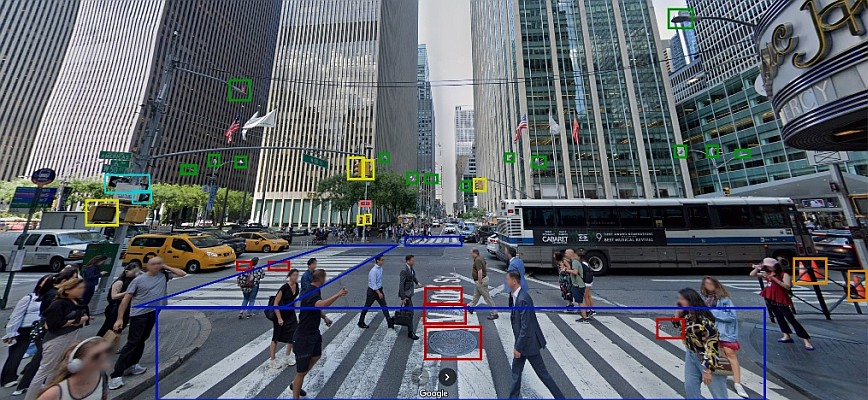
Bentley and Google announced a strategic partnership in October 2024 to integrate Google’s high-quality geospatial content with Bentley’s infrastructure engineering software to improve the way infrastructure is designed, built, and operated. The unique Imagery Insights combination of Google Street View, Vertex AI, and Blyncsy will enhance the ability of departments of transportation, and the engineering firms and consultants supporting them, to identify areas of concern and analyze changes in the condition of roadway and transportation assets over time.
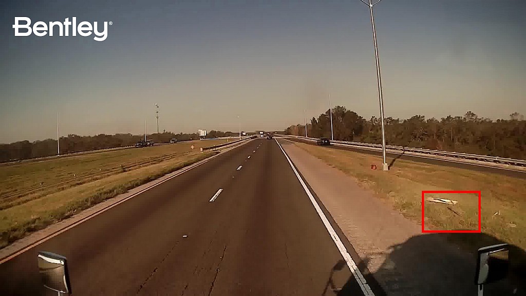
highway sign after Hurricane Helene in Florida. (Photo: Bentley Systems)
The addition of Google Street View’s global panoramic imagery allows Bentley to provide highly detailed analysis of assets along with visual references, while Google’s Vertex AI adds the ability to build and maintain models to alert transportation agencies of changes to infrastructure assets before they become safety hazards. In addition to supporting roadway maintenance activities, these capabilities can also aid in disaster recovery efforts, providing a cost-effective solution for conducting rapid damage assessments, which can help affected communities rebuild faster.
Mark Pittman, director of Transportation AI at Bentley commented, “We have a history of leadership in applying repurposed imagery for roadway maintenance, and the addition of Google’s 360-degree imagery and AI will further enhance the value Bentley provides to transportation departments and engineering firms globally. The expansion of our relationship with Google will enable us to further develop our growing infrastructure asset analytics capabilities—initially in the transportation sector with other industries to follow.”
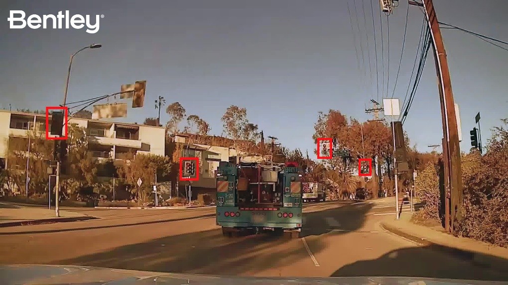
in crowdsourced dash cameras in the Los Angeles area after wildfires caused
major damage to critical safety infrastructure. (Photo: Bentley Systems)
Yael Maguire, Google’s vice president and general manager for Google Maps Platform & Google Earth, added, “Businesses and cities have long relied on the fresh and comprehensive information from our maps to get insights about the world. As our strategic partner, Bentley combines industry-leading infrastructure solutions with Google’s leading AI and mapping technologies, like Vertex AI and Street View, to bring powerful analytics to public and private sector leaders who need mobility insights for making more informed decisions.” Blyncsy is part of Bentley Asset Analytics, a portfolio of products that generate insights into the condition of existing infrastructure assets to optimize their performance. Google’s Imagery Insights will be generally available in Blyncsy in 2025.


