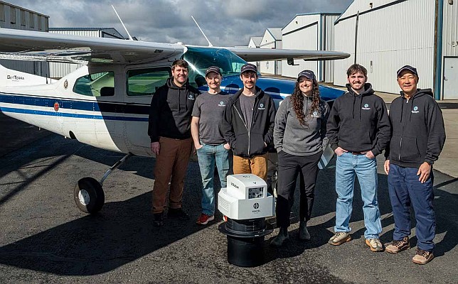
Vexcel Imaging is pleased to announce that GeoTerra, a U.S.-based aerial mapping service provider, has acquired the UltraCam Merlin 4.1 2010 digital aerial camera system.
This marks GeoTerra’s transition to Vexcel’s fourth-generation camera systems and reinforces their commitment to delivering versatile, reliable, and high-accuracy imagery for engineering and government mapping projects at all levels.
GeoTerra supports diverse mapping projects across the United States, with a strong operational focus on the Pacific Northwest (PNW) – a region known for its rugged landscapes terrain and unique weather conditions. These environmental challenges demand dependable and adaptable technology. The UltraCam Merlin 4.1 addresses this need, ensuring GeoTerra can deliver consistent, high-quality data for projects ranging from large-scale orthophoto programs to precise, small-scale engineering work.
The decision to invest in the UltraCam Merlin 4.1 was both strategic and practical, driven by performance, compatibility, and cost-effectiveness. GeoTerra recognized the need to update its older, heavily used systems to maintain technological competitiveness, while keeping operating costs manageable. The system delivers robust performance and enhanced image quality, supported by a great base-to-height (B/H) ratio for photogrammetric data collection.
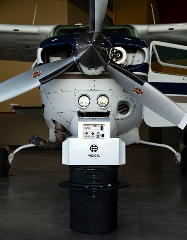
It is also GeoTerra’s first system compatible with Vexcel’s proprietary Adaptive Motion Compensation (AMC) and True Pixel Processing (TPP) algorithms — technologies available exclusively on 4th generation systems. AMC ensures consistently sharp images by dynamically eliminating motion-induced blur in a multi-directional, scene-aware manner. It is integrated into the TPP workflow, which preserves all pixel information from initial exposure to the final data products, maximizing information retention. The resulting imagery accurately represents the captured scene with exceptional dynamic range, sharpness, and clarity.
Before making their final decision, GeoTerra extensively evaluated multiple camera systems and shared sample data with their end clients for review and feedback. The results clearly showed that Vexcel’s UltraCam Merlin 4.1 outperformed the competition, garnering the highest approval among GeoTerra’s customers. This validation was a key factor in GeoTerra’s choice to invest in the Merlin 4.1, reaffirming the company’s reputation for delivering exceptional quality and reliability.
“Integrating the new UltraCam Merlin 4.1 helps us stay at the forefront of technology while managing operational costs,” said Bret Hazell, President of GeoTerra. “This addresses our number one focus: to provide clients with the best overall value for aerial mapping services.”
GeoTerra has long relied on Vexcel camera systems, including the UltraCam LP, UltraCam XP and UltraCam Falcons. The addition of the UltraCam Merlin 4.1 continues this trusted partnership, empowering GeoTerra to meet evolving client demands with innovative, future-ready tools.
For more information, visit: www.vexcel-imaging.com.