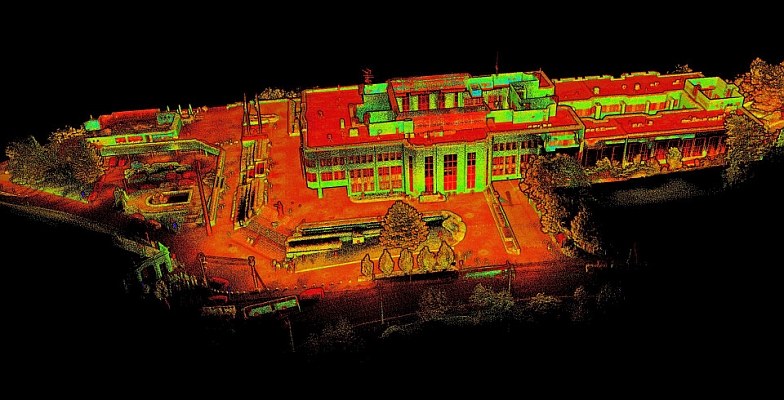
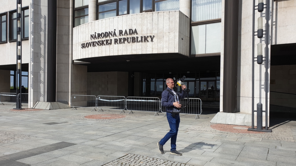
Every project requires right tool. The task was to scan the exterior of whole buildings of Slovak Parliament in Bratislava to have accurate data to create 3D model for planning the reconstruction works.
To fulfil the project requirements efficiently, we leveraged Lidaretto’s advanced capabilities as the sole scanning device. Lidaretto H32 was utilized for all scanning tasks. As UAV scanning was not possible due the security restrictions, easiest and fastest way was to use Lidaretto scanner in handheld configuration and scan everything in SLAM mode by simple walking around.
Scanning area is about 1.8ha. We were scanning 15 missions from 2 min to 21 min. Net scanning time was 2 h 12 min. We scanned everything in SLAM mode by simple walking around building complex including walking on the roof.
The result of scanning is accurate and georeferenced point cloud ready to be used for 3D modelling and further analyses, e.g. site surveys, terrain mapping, structural monitoring, and creating as-built documentation, accessibility by trucks, clearance control, etc. Using Lidar scanner can enhance your efficiency and safety in construction projects. Lidaretto is ultra versatile scanning system designed for ground and aerial scanning, supporting both PPK and SLAM positioning methods. Ideal tool for everyone who needs accurate 3D data. And it is made in EU.
For more information: www.lidaretto.com
Source: Lidaretto
MundoGEO organizes the DroneShow, MundoGEO Connect, SpaceBR Show and Expo eVTOL exhibitions annually in São Paulo, Brazil. See the highlights of the latest edition: