


OrbiView application, developed by DEPHOS Group from Poland, is a visual asset management platform built to support building and facility management by transforming complex reality-capture data into an intuitive digital environment. Facility managers gain immediate insight into layouts, installations, and asset.
Unlike traditional BIM solutions, OrbiView focuses on usability, operational efficiency, and cost control, making building information accessible to facility managers, technical teams, and decision-makers without specialized BIM expertise.
OrbiView significantly reduces the gap between documentation and reality. It allows teams to remotely assess conditions, verify spatial constraints, and understand technical environments before planning maintenance, refurbishments, or inspections. This leads to fewer site visits, faster decision-making, reduced dependency on specialist roles, and better coordination across operational, technical, and management teams throughout the building’s lifecycle.
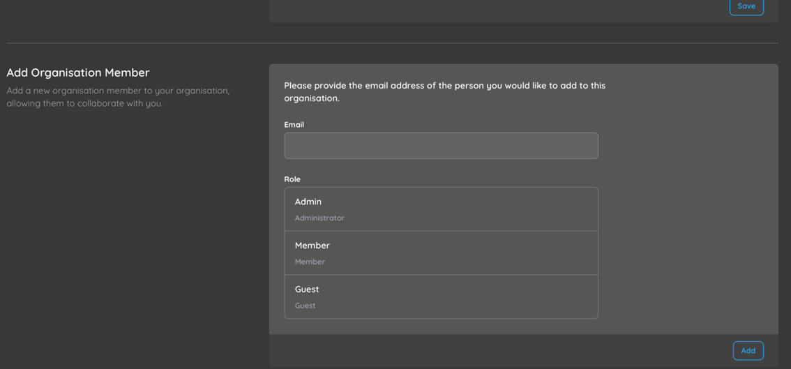
User Management and Access Control
OrbiView includes a comprehensive user and permission management system designed for multi-stakeholder building operations. This structure supports controlled collaboration while maintaining data security and operational clarity.
Data Input, Processing, and Outputs
OrbiView accepts RGB panoramic imagery and LiDAR point clouds in mostly used formats, ensuring compatibility with common scanning workflows. These datasets are processed centrally on the server using GPU-accelerated calculations. This transformation turns raw scan data into immediately usable operational information reducing scant-to-deploy time to absolute minimum.
Users access the same consistent, processed dataset through a browser-based interface, reducing IT overhead and training requirements. This approach supports scalable deployment across buildings, regions, or entire portfolios while maintaining uniform data quality.
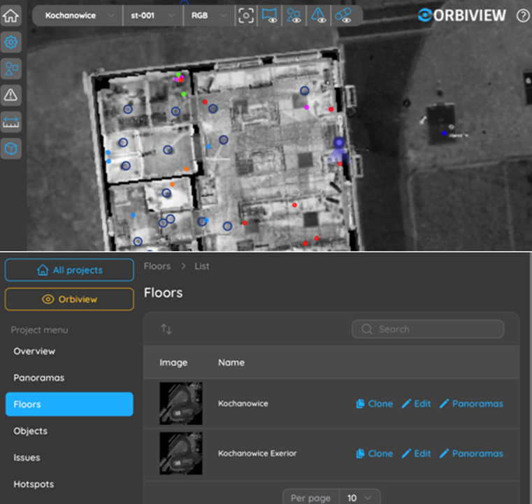
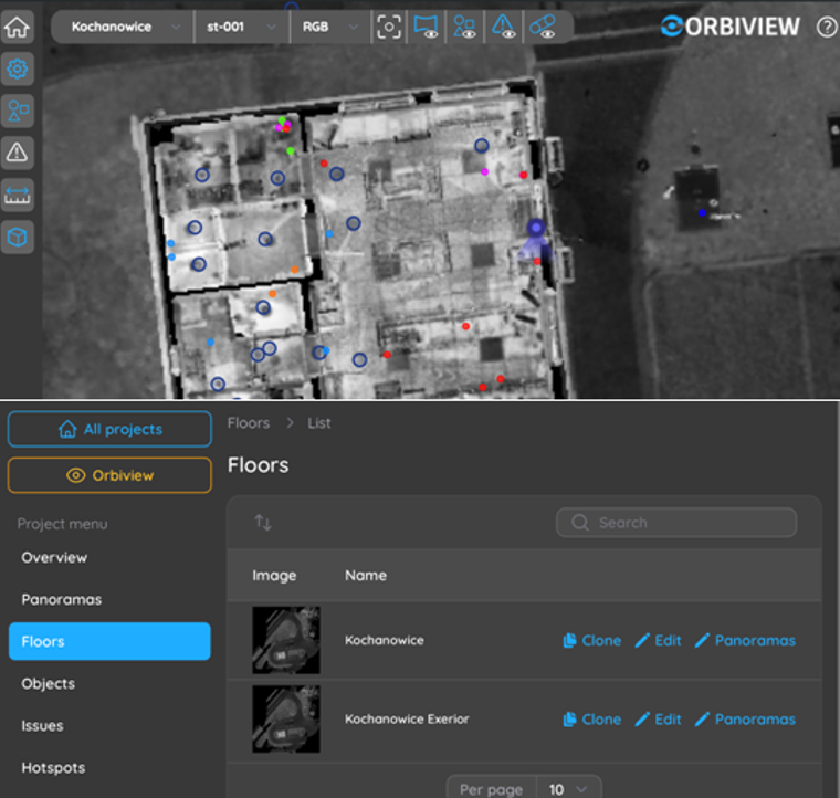
Project and Spatial Organization
OrbiView structures all building data into a clear hierarchy of projects, floors, and rooms that closely mirrors how facilities are managed in real life. This allows users to intuitively navigate even complex buildings, such as hospitals, industrial plants, or multi-tenant office properties. Automatically generated floor plans provide immediate spatial context and act as a primary navigation layer.
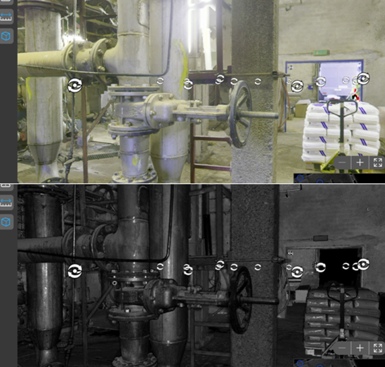
Navigation and Virtual Access
OrbiView enables seamless virtual navigation through buildings using interconnected panoramas, jump markers, and interactive floor plans. Users can move between viewpoints as if walking through the building. This capability supports remote inspections, onboarding of new staff, and collaboration with external stakeholders.
Metric Measurements and Spatial Verification
Every pixel in an OrbiView panorama is associated with an XYZ coordinate derived from the point cloud, enabling accurate measurements directly within the visual environment. Facility teams can measure distances, heights, clearances, angles, and areas without returning to site or commissioning additional surveys.
Plane Detection and Advanced Measurements
OrbiView automatically detects planar surfaces during data processing. These detected planes enable advanced measurement functions, including distance to surface, surface area calculation, and angle measurement between planes.
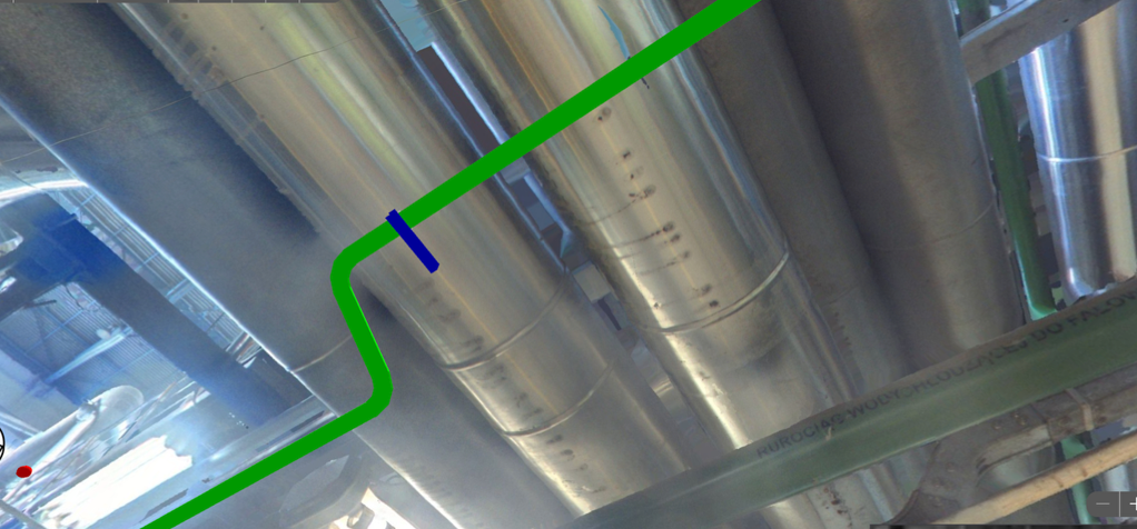
Object Creation and Asset Representation
OrbiView allows physical building elements to be represented as digital objects linked directly to their real-world geometry. Assets such as HVAC units, electrical panels, valves, fire safety equipment, or structural elements can be marked directly on panoramas using points, lines, or shapes. Each object is automatically visible in all relevant panoramas.
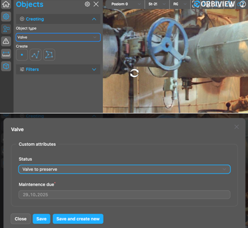
Custom Asset Database Structure
Each object in OrbiView can be enriched with an unlimited number of custom attributes tailored to facility management requirements. Attribute types include text, numeric values, dates, URLs, boolean fields (true/false), dropdown lists, and relationships to other objects. This allows organizations to model assets according to internal standards and operational processes.
Tabular view and Reporting
In addition to visual navigation, OrbiView provides structured table views that display assets and their attributes in a clear, data-driven format.
The direct link between table entries and visual asset locations significantly improves clarity and reduces misinterpretation, improving confidence in planning, prioritization, and resource allocation.
Linked Documentation and File Management
The platform allows external files to be linked directly to assets or issues. Files can be stored as shared project library documents or as object-specific attachments, reducing duplication and simplifying document control.
Issue Management and Condition Tracking
OrbiView includes an integrated issue management system for documenting defects, damages, and maintenance needs directly within the visual building context. Issues can be attached to specific assets or placed freely within panoramas to mark exact locations.
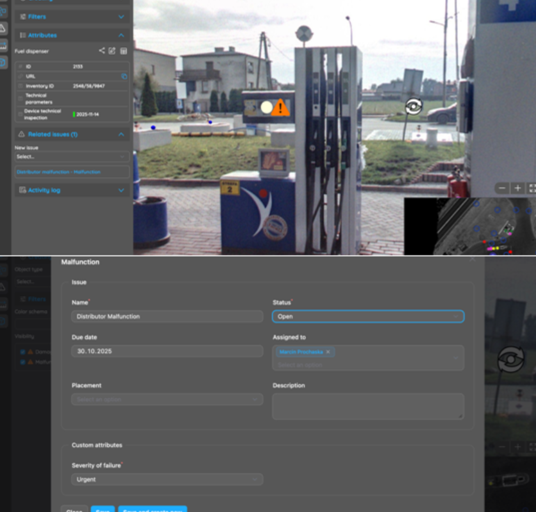
Issue Assignment, Communication, and Notifications
Issues in OrbiView can be assigned to users, including internal maintenance teams or external contractors. Assigned users receive automated notifications via the platform and email, each containing a direct link to the issue and its visual context.
3D Model Integration
OrbiView supports the placement of 3D models directly into existing panoramas to visualize planned installations, modifications, or design concepts. Models can be positioned using fixed coordinates or interactively aligned within the visual environment.
Deployment Options and System Integration
The platform can be deployed as a SaaS solution, hosted on third-party cloud infrastructure, or installed locally on client servers to meet data security and IT governance requirements. This flexibility makes OrbiView suitable for public-sector organizations, private enterprises, and critical infrastructure operators.
OrbiView in Relation to BIM
For operational building management, OrbiView delivers many BIM-like capabilities—such as spatial context, measurements, asset data, and collaboration—without the cost and complexity of creating and maintaining detailed BIM models. It focuses on usability, accessibility, and operational value rather than design-phase detail.
| OrbiView | BIM | |
| Data source | 3D laser scans, 360o panoramas | 3D laser scan, 2D documentation |
| Data preparation | Automatic data processing | Labor intensive modeling necessary to achieve acceptable results |
| Ease of use | Images are easy to understand for non-professionals | Requires deep knowledge of BIM environment |
| LOD | Unlimited Level of Details, every object is visible in natural shape and color | Higher LOD requires increase in modeling time |
| User defined database | YES | YES |
| Information | Information can be attached to any object on a picture | Information can be attached to the previously modelled items only |
| Issue tracking | Issues can be attached to specific objects or freely placed on an image | Issues can be attached only to previously modelled objects |
| Costs | LOW: Data capture and system hosting only | HIGH: Data capture, modelling and system hosting |
Key Benefits for Building and Facility Management
OrbiView provides building management teams with accurate, accessible, and visually intuitive information that supports faster decisions, improved coordination, and reduced operational risk. By minimizing site visits, simplifying asset documentation, and centralizing data, the platform lowers costs and improves efficiency.
For more information, visit: www.orbiview.com
Discover the schedule of courses, seminars, and forums for DroneShow Robotics, MundoGEO Connect, SpaceBR Show, and Expo eVTOL. Registration is available in advance with a discount, and spaces are limited.
See the highlights from the last edition: