Fugro has secured a new five year indefinite delivery, indefinite quantity (IDIQ) contract from the US Army Corps of Engineers (USACE) to provide surveying and mapping services supporting civil works and military infrastructure programmes across the US and overseas. The contract underpins USACE’s management of critical waterways, flood risk systems and military facilities, enabling timely, high quality geospatial data to inform infrastructure planning, risk management and operational readiness in complex and demanding environments.
The award builds on a long standing relationship between USACE and Fugro, which has supported Corps programmes for more than three decades by delivering accurate, decision ready Geo data for planning, construction, asset management and environmental stewardship across a wide range of infrastructure systems. The contract is being administered by USACE’s St. Louis District, which plays a leading role in shaping how geospatial data is applied across the Corps’ civil and military activities.
Under the contract, Fugro will deliver work through task orders, collecting high resolution geospatial data using crewed and uncrewed platforms and applying cloud based, AI enabled automation with expert oversight to deliver mapping and survey products. Together, these capabilities support consistent data delivery across diverse operating environments, helping project teams make well informed decisions on accelerated timelines.
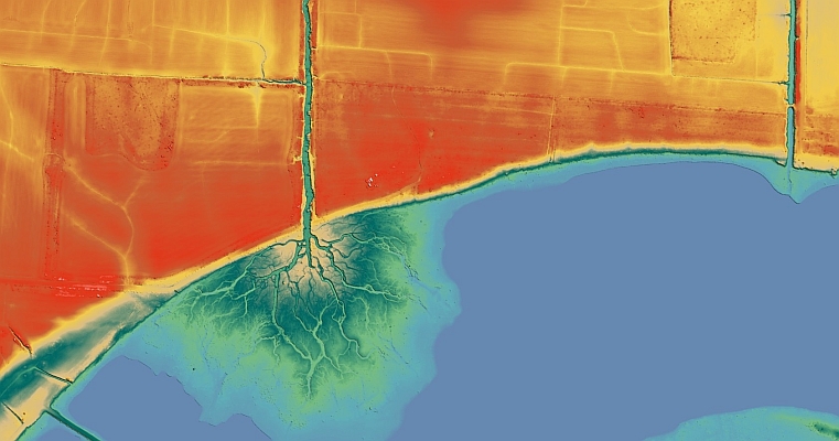
Task orders from the previous IDIQ illustrate how this work supports USACE priorities in practice. On the civil side, Fugro is delivering mapping and elevation data for the Upper Mississippi River Restoration Program, supporting navigation management and environmental rehabilitation along one of the nation’s busiest inland waterways. For military infrastructure, Fugro is collecting aerial imagery and high density lidar data across multiple US Army installation sites in Alaska for land use planning, facility maintenance and operational decision making in remote and logistically challenging environments.
“The U.S. Army Corps of Engineers relies on consistent, high quality geospatial data to plan, maintain and modernise infrastructure across an exceptionally wide range of environments,” said Dave White, Fugro’s Geospatial Programme Director in the Americas. “This contract reflects USACE’s need for scalable mapping and survey capability and our ability to deliver reliable, decision ready Geo data in support of critical infrastructure and national readiness.”
Source: Fugro
MundoGEO organizes the DroneShow, MundoGEO Connect, SpaceBR Show and Expo eVTOL exhibitions annually in São Paulo, Brazil. See the highlights of the last edition: