Drones and Robotics
Space
eVTOL
Geospatial Technologies
Newsletter
WhatsApp
Exhibitions
DroneShow Robotics
MundoGEO Connect
SpaceBR Show
Expo eVTOL
Smart City Business
Exhibitors
Lives
Videos
Webinars
About Us
Social Networks
3d maps
News
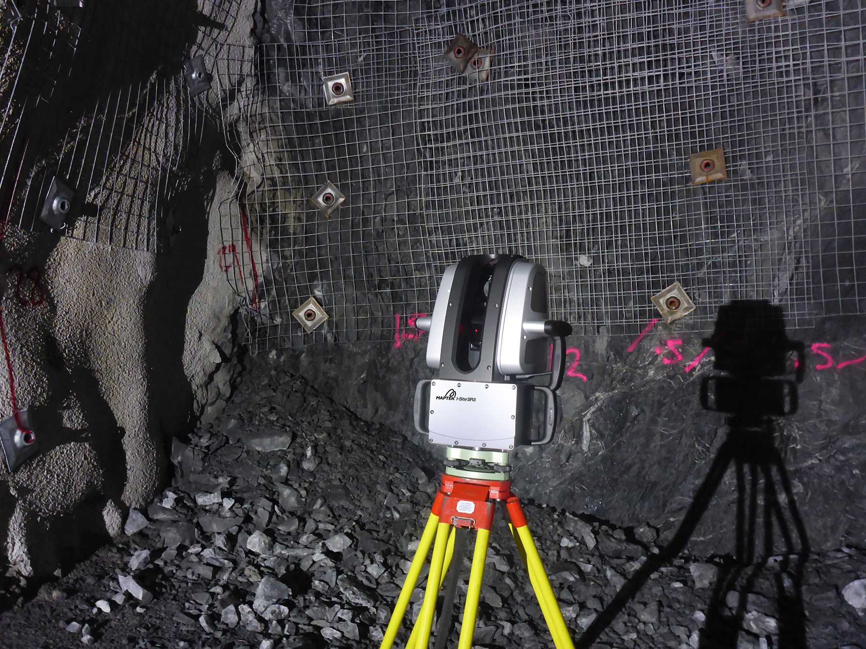
New SR3 underground laser scanner from Maptek
News
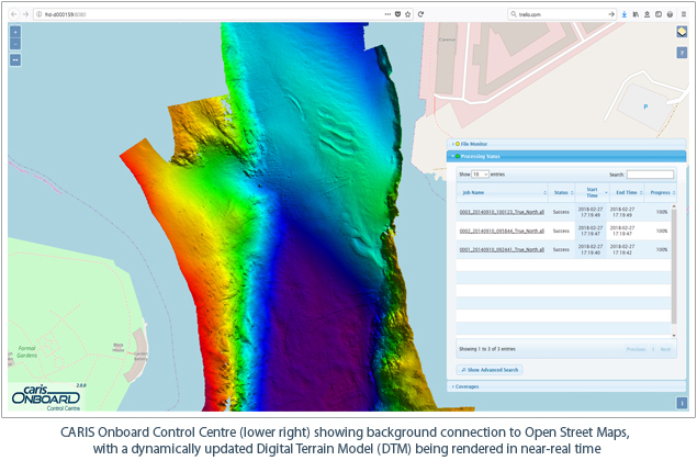
Real-time Mapping and Visualization in CARIS Onboard 2.0
News
Bluesky: New Office and Start to Aerial Surveying in Ireland
News
Brain of Smart City: A GIS Platform for Sharing 2D and 3D Maps
News
Zebra Imaging announces 3D geospatial challenge
Editorials
Drones and Robotics
eVTOL
Geospatial Technologies
Space
Live Schedule
14 April 2026 - 16h00
Sem informação geográfica não há cidade inteligente
31 March 2026 - 16h00
Operar drones de forma irresponsável pode gerar multas e dever de reparação
26 March 2026 - 16h00
AlphaAir 6 – O Novo Padrão do LiDAR Aéreo
24 March 2026 - 16h00
Mudanças na regulamentação de drones que estão por vir
Video
2025 Feira/Exhibition MundoGEO Connect | DroneShow Robotics | SpaceBR Show | Expo eVTOL
Sign up for our newsletter
Enter your email
Invalid Email
Calm down, we will not share with any third parties.
Confirm Subscription