Drones and Robotics senseFly launches eBee e-learning platform and operator certification program to advance drone knowledge
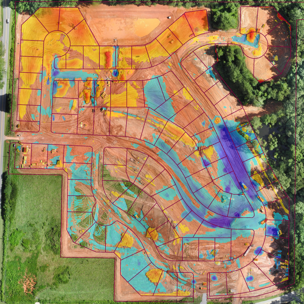
Drones and Robotics Virtual Surveyor Drone Surveying Software Simplifies Workflow for Earthworks Monitoring at Construction Sites
Geospatial Technologies SPOT 6/7 imagery to feed Satshot’s mapping platforms for improved efficiency of US agriculture
Drones and Robotics BZ Media and Skylogic Research Release “5 Valuable Lessons Learned About Drones in Agriculture”
Drones and Robotics Agribotix Launches First On-Demand Data Processing Platform For Agricultural Drones