PIX4Dcatch is a powerful app designed to capture a wide array of details, from underground utilities to intricate construction features. It utilizes iPhone’s LiDAR for speedy and precise mapping and is compatible with Android devices as well. Perfect for construction, public safety, and surveying, this app when integrated with PIX4Dcatch RTK sets a new standard in terrestrial photogrammetry.
We’ve already covered the basics in our comprehensive video. In this article, let’s explore some common mistakes users make and how you can avoid them for a seamless data capturing experience.
Scanning a stockpile

Don’t:
- Walk too fast
- Change the angle of the device mid-scan
- Repeatedly capture from the same angle and height
Do:
- Walk at a slower pace than usual in a circular motion around the stockpile. Keep your mobile device at a fixed angle that allows the entire embankment to fit within its view, as changing the device angle midway could compromise the 3D model’s quality
Capturing data on flat surfaces
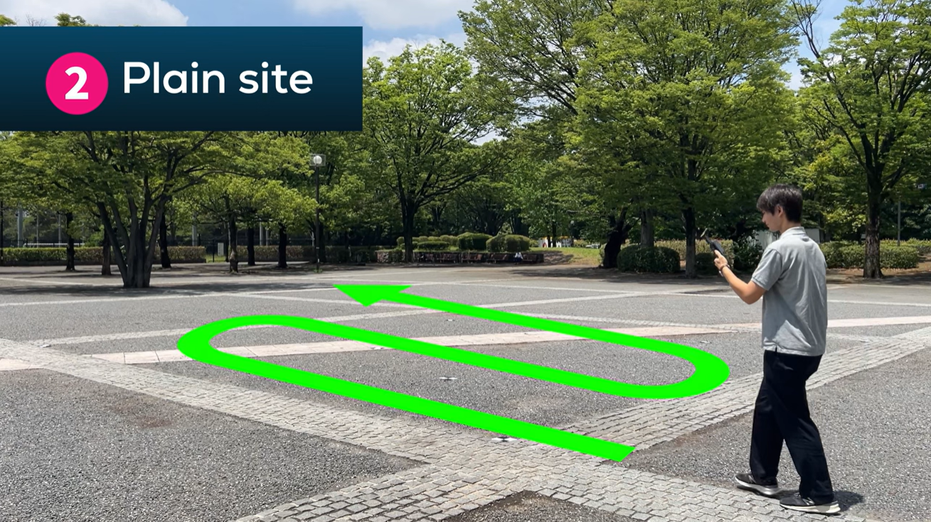
Don’t:
- Take sharp turns
- Point the camera directly downwards
Do:
- Walk straight and turn gently in a path that traces the target area in a single stroke. Maintain a fixed angle, and remember that the distance between each walkway should be approximately 2.5 meters. Tilting the device slightly is better than pointing it downwards, as the latter affects satellite data acquisition, especially when using an external PIX4Dcatch RTK
Scanning slopes

Don’t:
- Change the angle of the device while scanning
Do:
- Walk parallel to the slope and ensure the entire slope fits within the device’s field of view. Hold the device slightly tilted forward, but not directly in front of the slope
Scanning structures
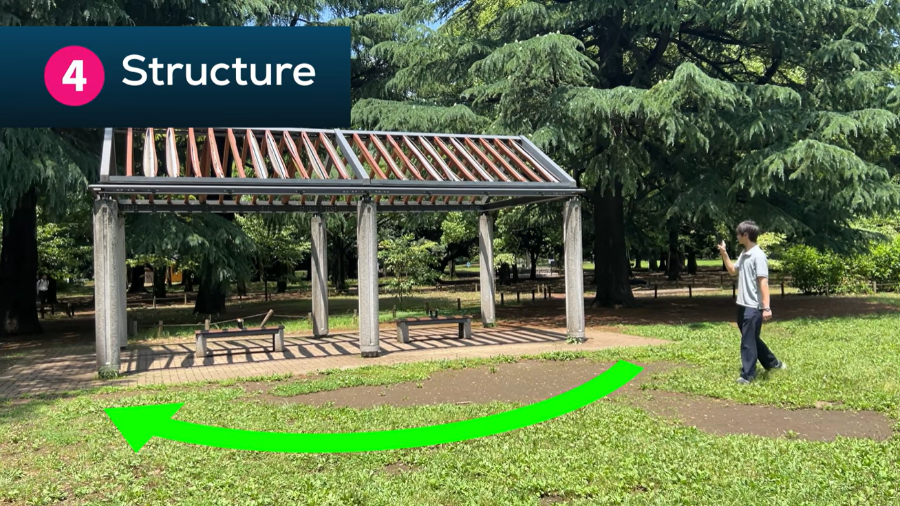
Don’t:
- Repeatedly capture from the same angle and height
- Make abrupt changes to the device’s angle
Do:
- When capturing a structure, walk around it in a circular motion, keeping your mobile device at a fixed angle. If you need multiple scans, vary the angle and height to avoid duplication in the 3D model’s surface
For an in-depth understanding of PIX4Dcatch‘s capabilities and best practices, refer to the official support materials. Master these tips, and you’ll be well on your way to capturing data like a pro!
Con informaciones e imágenes de Pix4D
DroneShow Robotics, MundoGEO Connect, SpaceBR Show y Expo eVTOL 2024, del 21 al 23 de mayo en Sao Paulo, Brasil. Vea un resumen de la última edición de la feria: