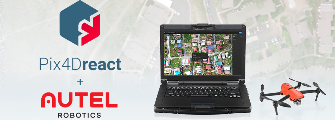
Now compatible with all Autel Evo II camera models for real color mapping, Pix4Dreact is specifically designed to provide quick and reliable situational awareness to first-responders while in the field. Fast, lightweight, easy-to-use and robust, it can produce high-quality 2-dimensional orthomosaic maps when time is of the essence. It is the perfect software companion to the Autel Evo II, enabling teams on the ground to respond quickly and safely.
These new bundles include the Autel Evo II drone (available with 8k, 6k, or Dual camera options), a hard carrying case, one additional flight battery and a yearly license of Pix4Dreact. This collaborative effort between Autel Robotics and Pix4D combines one of the fastest “out of the box, into the air” drones on the market with Pix4D’s fast-mapping software for emergency response.
“We are very proud to partner with Autel Robotics to bring this simple-to-use yet powerful drone-mapping solution to first responders”, says Christopher Cressy, Managing Director for Pix4D North America. “The Evo II is an impressive drone platform and ideally suited to public safety missions. It’s light, fast, and easy to operate. Paired with Pix4Dreact and a simple laptop computer, any drone pilot or responder on the ground can generate and share a high-resolution scale map in minutes, anywhere in the world, with or without network connectivity.” Gary DeLuca, Autel Robotics USA’s CEO, adds “At Autel Robotics, we are proud to offer the fastest rapid-deployment aircraft in the industry, and the speed of Pix4Dreact is the ideal complementary application for our aircraft. No other application, and no other aerial product in public safety and construction industries output actionable data as efficiently, accurately, and with quality orthomosaics as Pix4Dreact partnered with Autel Enterprise.”
To know more about Pix4D and our solutions visit pix4d.com.