

Mines require the collection and processing of large amounts of information with great accuracy. In the case of coal or iron ore mines, inaccurate measurements result in inefficient operations and can even affect the outcome and quality of the project.
Traditional measurement methods require surveyors to go to the site to perform the measurements which is not safe and time-consuming. Also, the data results are presented by several single 3D measured points which is difficult to meet the digital requirements of modern mines for rapid updates. But UAV LiDAR solutions can help overcome the challenging topography, hazardous conditions, and other typical mine site issues.
Light Laser Detection and Ranging (LiDAR) is one of the most cutting-edge technologies in the field of surveying and mapping today. Installed on a drone for mine surveys, it allows to measure the three-dimensional coordinates of objects on the ground, to penetrate the vegetation and to apply a point cloud filtering method to generate a high precision DTM. Aerial surveying eliminates safety concerns for on-site surveyors, and it takes only minutes to hours to complete the measurement of the entire site, significantly improving production efficiency.
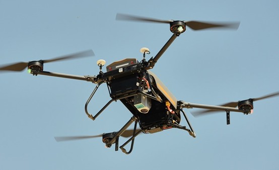
The case study was carried out in a typical mine site environment to produce an actual three-dimensional model of the current site, replacing the typical two-dimensional CAD drawings and photos. The BB4 UAV, AlphaAir 450 LiDAR scanner and CoPre software from CHCNAV and Global Mapper software from Blue Marble Geographics were used in this project.
Read the case study to discover how to perform a LiDAR survey of a mine site in 3 steps: https://chcnav.com/about-us/news-detail/topographic-mapping-with-uav-lidar-to-increase-the-output-of-mining-operations