



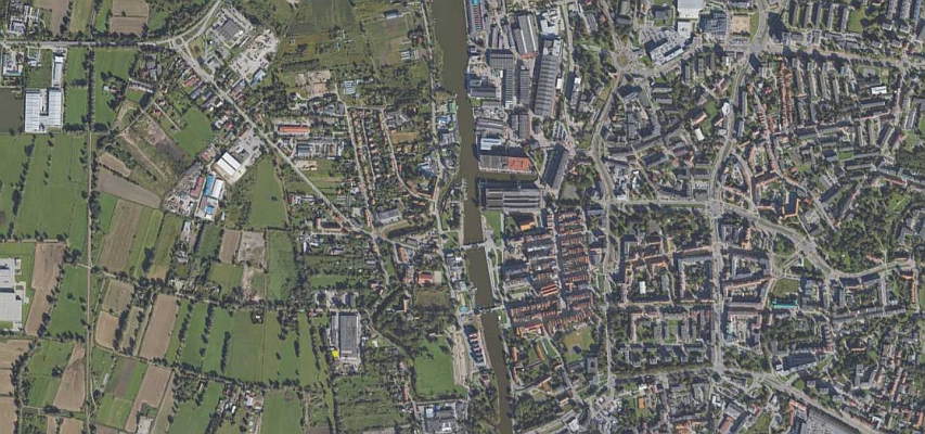
Europe sets some of the most demanding quality standards for aerial photogrammetric and LiDAR data. Public tenders issued by national mapping agencies, municipalities, and infrastructure operators define strict quality parameters – from ground sampling distance of 2–5 cm in urban areas to point cloud densities reaching 100 pts/m² for linear infrastructure. In practice, this means centimetre-level precision across data volumes reaching tens to hundreds of terabytes per contract, on tight delivery schedules.
These are contractual requirements, enforced through quality control procedures and financial penalties. They include geometric accuracy (RMSE), radiometric parameters and point cloud classification compliant with ASPRS standards. In some cases, tenders require simultaneous acquisition of imagery and LiDAR data in a single flight, ensuring full geometric and temporal consistency of final products. In practice, this demands precise mission planning, sensor synchronization, and operations within narrow weather windows.
Raw data is not enough
Scale compounds the challenge. Projects often cover full regions or entire countries, and contracting authorities want more than raw files – they increasingly expect ready-to-use tools for visualization and analysis. Data must be immediately operational, shifting the focus from acquisition alone to the full data lifecycle – from capture, through processing, to end-user delivery.
Meeting these requirements takes a complete value chain — from fleet and sensors through processing to the end-user platform. That is the model OPEGIEKA has built over 15 years of aerial operations across 23 European countries.
Fleet and hybrid sensors
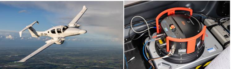
OPEGIEKA operates a fleet of six aircraft, each matched to a specific mission profile: a Beechcraft King Air C90A for large-area national campaigns, two Diamond DA 62 MPPs for hybrid LiDAR and imagery missions, a Tecnam P2006T SMP dedicated to high-resolution urban work, and two Vulcanair P68 platforms for standard photogrammetric missions. The same thinking applies to sensors.
Traditional two-sensor setups — separate camera, separate LiDAR, often two flight passes — are slower, costlier, and leave you aligning datasets in post-processing. Our answer is a deliberate investment in Leica’s hybrid instruments: two CityMapper-2S units for urban work (nadir and four-direction oblique imagery plus LiDAR in a single pass) and a CountryMapper-S for large-area campaigns (large-format RGBN camera plus LiDAR in one unit). Additional specialized equipment, such as high-frequency LiDAR scanners and thermal sensors, supports infrastructure inspection and sector-specific applications.
The People Behind the Data and Petabytes in Own Data Center
Over 115 specialists across Elbląg and Warsaw offices cover every role the work demands: pilots, sensor operators, geodesists, photogrammetrists, GIS specialists, and IT engineers. This combination of expertise enables accurate data acquisition and advanced processing alike – from aerotriangulation and automated image quality control to point cloud classification and 3D model generation. Artificial intelligence and machine learning methods are increasingly used to support these processes, improving efficiency while maintaining high quality standards.
Processing infrastructure is another critical component. OPEGIEKA’s own data center in Elbląg includes a dedicated aerial processing cluster with 600 CPU cores, 3.2 TB of RAM, and 26 GPUs for AI- and ML-driven workflows, backed by over 3 PB of storage. Dual power with diesel backup, dual ISP connectivity, and ISO 27001 certification ensure reliable, auditable operations.
Ready-to-Use Products and Platforms
Files on a disk are no longer the finish line. Tenders in Norway, Finland and Poland often mandate a browser-based platform delivered alongside the data. SimplyGeo *, developed by OPEGIEKA, is one such solution – a single interface for browsing orthophotos, oblique imagery, 3D models, and point clouds with measurement tools and integration into existing GIS environments. Integration of data with analytical tools lowers the barrier for end users and enhances the overall value of spatial information.

Fifteen years of aerial operations across 23 European countries, four divisions covering acquisition, processing, R&D, and platform delivery, and our own infrastructure end-to-end — this is the baseline a contractor needs before the first technical question in a European tender gets asked.
OPEGIEKA is a Polish company operating in the GEO/ICT market since 1989, delivering both business and scientific projects for clients across Poland, Europe, and the United States. The company holds the status of a Research and Development Center (CBR) granted by the Minister of Economy, as well as first-level industrial security clearance, enabling it to handle classified information up to SECRET, EU SECRET, and NATO SECRET levels. It is also certified under ISO 9001 and ISO 27000 standards.
OPEGIEKA provides a comprehensive range of geospatial services, including the acquisition and processing of spatial data, the development of dedicated IT systems, and the delivery and maintenance of end-user solutions. The company operates its own Tier III Data Center under the DC4B.PL brand, supporting cloud services and machine learning technologies.
With its own fleet of aircraft, drones, LiDAR remote sensing systems, and large-, medium-, and thermal-format aerial cameras, OPEGIEKA is equipped for advanced data collection. Its in-house IT department develops sophisticated systems using both commercial and open-source technologies, including GIS, ETL, and Big Data solutions.
For more information on high quality data collection and processing contact jakub.krawczyk@opegieka.pl Head of R&D and Remote Sensing at OPEGIEKA
Find more: www.opegieka.pl
OPEGIEKA, part of the Dephos Group consortium, is confirmed as an exhibitor at the DroneShow, MundoGEO Connect, SpaceBR Show, and Expo eVTOL 2026 trade show, which will be held from June 16th to 18th at Expo Center Norte – Blue Pavilion, in São Paulo (SP).
Check out the schedule of courses, seminars, and forums at DroneShow Robotics, MundoGEO Connect, SpaceBR Show, and Expo eVTOL. Registration is available in advance with a discount, and spaces are limited.
See the highlights from the last edition: