MundoGEO
English
  • Drones and Robotics
  • Space
  • eVTOL
  • Geospatial Technologies
  • Newsletter
  • WhatsApp
  • Exhibitions
    • DroneShow Robotics
    • MundoGEO Connect
    • SpaceBR Show
    • Expo eVTOL
    • Smart City Business
    • Exhibitors
  • Lives
  • Videos
  • Webinars
  • About Us
  • Social Networks

topodrone

Geospatial Technologies
Topodrone–Rasa Surveying partnership augments coastal mapping, serves resilient communities
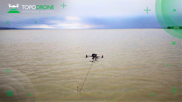
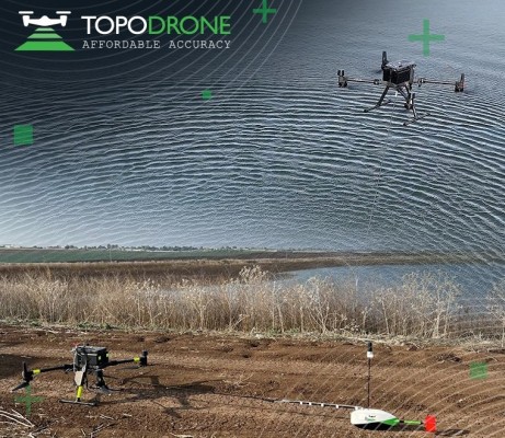
Drones and Robotics
TOPODRONE synchronized LiDAR and bathymetric surveying methods to study a floating solar farm in Israel
Drones and Robotics
Elevating high-precision aerial lidar mapping with TOPODRONE and Velodyne Lidar 10:34
Drones and Robotics
TopoDrone -100 Captures unparalleled near infra red mapping data
Editorials
  • Drones and Robotics
  • eVTOL
  • Geospatial Technologies
  • Space
Live Schedule
26 March 2026 - 16h00 AlphaAir 6 – O Novo Padrão do LiDAR Aéreo
24 March 2026 - 16h00 Mudanças na regulamentação de drones que estão por vir
19 March 2026 - 16h00 Vertiportos – Oportunidades de Negócios
17 March 2026 - 16h00 Delivery com drones no Brasil já é realidade?
12 March 2026 - 16h00 GSB360 – Plataforma Integrada para Profissionais de Escaneamento Laser 3D
11 March 2026 - 16h00 Convierte tu proyecto de Geo AI en una solución monetizable y con escala
See all lives
Video
2025 Feira/Exhibition MundoGEO Connect | DroneShow Robotics | SpaceBR Show | Expo eVTOL
See all videos
Sign up for our newsletter
Invalid Email
Calm down, we will not share with any third parties.
MundoGEO
  • About Us
  • Archive (blog and articles)
© Copyright