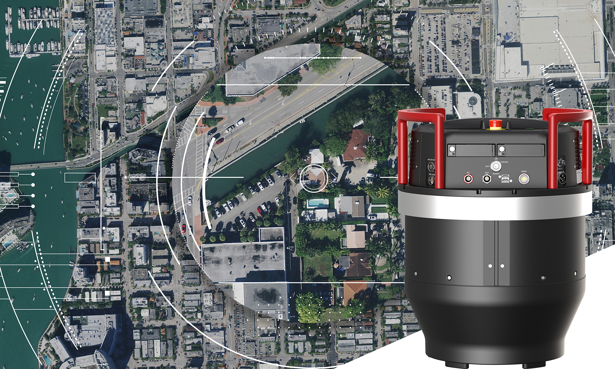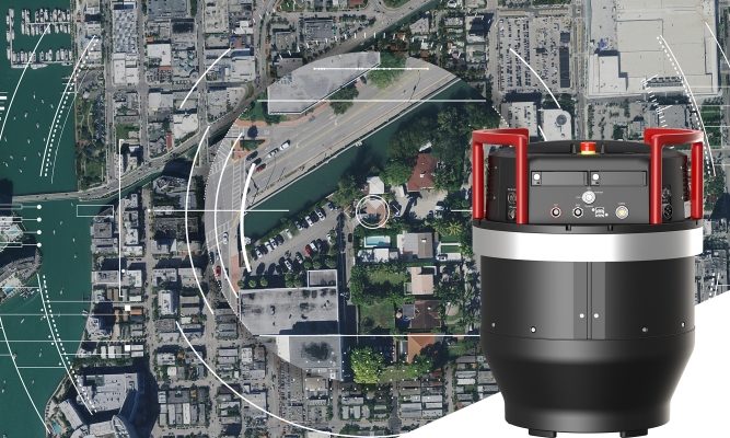
Hexagon’s Geosystems division announced today the introduction of the Leica ContentMapper, an innovative and highly efficient airborne imaging sensor for large-scale geospatial mapping projects. With a 40,000 pixels swath width, this latest generation camera provides the highest performance for content programs, capturing high resolution imagery at unprecedented rates.
Leica Geosystems’ latest airborne sensor was commissioned by the HxGN Content Program, the largest library of aerial imagery and elevation models, to enable the highest aerial data capture efficiency. The new camera provides double the resolution at the same flying parameters compared to previous systems and keeps up with the fastest flying speeds while creating highly accurate and detailed imagery even in challenging lighting conditions.
“The ContentMapper was purpose-built for content programs and is packed with all of Leica Geosystem’s latest technology, perfectly tuned and configured for large-scale to country-sized imagery projects,” says John Welter, president for geospatial content solutions at Hexagon. “Now that the new camera is operational, we are looking for collection partners around the world to operate the system and help us grow the program,” he adds.
High-performance, modular optics provide foundation for next-generation airborne cameras
The ContentMapper utilises Leica Geosystems’ revolutionary MFC150 optical system in a custom configuration. The high-performance, metric CMOS camera delivers higher accuracy thanks to calibrated custom-built lenses in RGB and near-infrared images. Each of the integrated optical units features independent, mechanical forward-motion-compensation (FMC) and benefits from Leica Geosystems’ recent advancements in selective sharpening and auto colour correction.
“The first large-format camera system based on MFC150 technology is built for speed and imagery collection efficiency. Our experience with the ContentMapper system configuration will benefit the entire Leica Geosystems product portfolio as we integrate the cutting-edge optics into future imaging sensors,” says Werner Kirchhofer, CTO for airborne solutions at Leica Geosystems. “By combining the new solution with the Leica HxMap high-performance, unified post-processing workflow, we create the most powerful, end-to-end aerial mapping solutions in the world, capable of accurately mapping the finest details and being configured for large-scale collections such as the HxGN Content Program.”
“We are building foundational high-tech components for airborne imaging and LiDAR surveys, as well as a data processing ecosystem, which will give our customers more options for sensors that meet today’s and tomorrow’s requirements,” stated Layton Hobbs, product line director for airborne solutions at Leica Geosystems. “We recognise that our customers need to be agile. We actively listen and build complete sensor solutions which allow them to adapt to rapidly changing needs of their end-customers.”