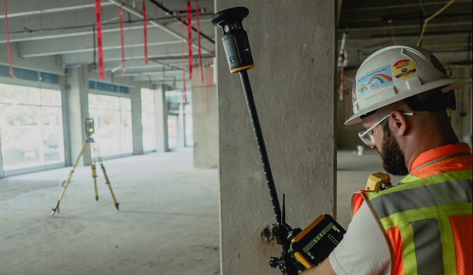
Netpipe announced the official launch of 3tag, a Standalone Handheld GNSS surveying solution, designed and engineered in Germany to put survey-grade accuracy in the hands of every construction and landscaping site team.
Accurate survey data on modern construction sites too often arrives late, lives in separate systems, and requires constant back-and-forth between the field and the office. Specialist surveyors are hard to come by, workflows are fragmented, and by the time a usable report reaches the office, the crew on site has already moved on.
3tag solves this with a fully integrated standalone system: hardware, GNSS, laser measurement, software, and reporting are all developed in-house and run as one closed system on a single device. No office post-processing, no external app, no cloud subscription. Site teams capture centimetre-accurate positions, calculate volumes, and get finished reports on the spot – in one single, closed workflow.
3tag is not a replacement for high-end geodetic instruments. It is the scalable addition for daily site operations – putting survey-grade accuracy directly in the hands of field crews, without weeks of training and without waiting for a specialist.
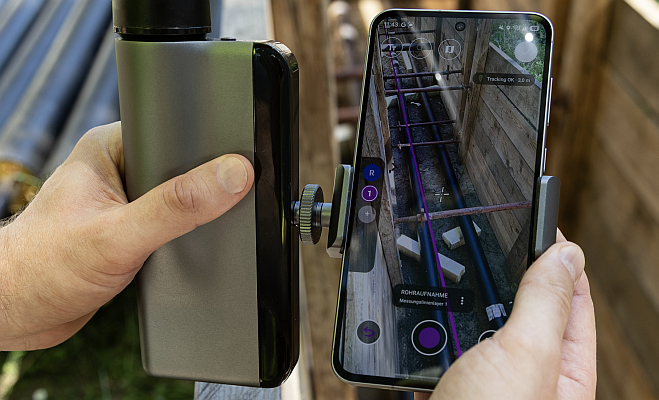
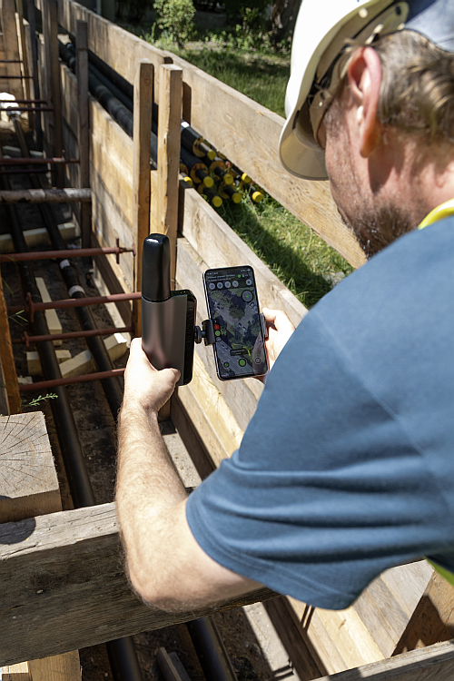
The 3tag handheld device is designed to help site teams collect accurate field data without the time-consuming processes often associated with conventional total stations or multi-step surveying equipment. By streamlining data capture and reducing manual inputs, 3tag enables organisations to improve productivity, accelerate project delivery, and make informed decisions based on reliable site information—whether they are setting out a foundation edge, checking as-built positions, verifying cut-and-fill volumes, planning grading for outdoor spaces, or documenting underground utilities.
“Construction teams are under constant pressure to deliver projects faster, more efficiently, and with fewer specialist resources,” said Jan Rentsch, CEO of 3tag. “We built 3tag for the moment when a site team realises it does not have to wait for a specialist just to get a critical measurement. Because we control the entire system (hardware, GNSS, software stack and reporting), crews get centimetre-accurate results and a finished report in one closed device, with no external software dependencies, no fragmented toolchain, and no external cloud dependencies. Simple, efficient, and built to last.”
Automated measurement for faster site workflows
A key innovation of the new solution is its integrated laser distance measurement capability, which automatically compensates for device height during data collection. Unlike traditional surveying workflows that often require manual measurements and software adjustments, 3tag automatically calibrates measurements in real time, reducing opportunities for human error and accelerating field operations. This allows users to work more flexibly on site while maintaining confidence in the accuracy of collected data, with no manual configuration required from the crew.
Powered by integrated RTK GNSS technology
At the heart of the device is a state-of-the-art GNSS positioning engine which, when coupled with an integrated RTK correction service, provides centimetre precision out of the box for the construction worker. The integrated service delivers centimetre-level accuracy from the moment the device is switched on, eliminating the hidden maze of separate software licenses, app subscriptions, and external correction fees that traditionally drive up the total cost of ownership.
These capabilities allow users to capture accurate positioning data more quickly and maintain reliable performance even when working near tall buildings, infrastructure, or other obstructions across a wide range of real-world environments, from open civil sites to complex urban projects.
Built for modern construction and landscaping projects
Construction and landscaping projects across Europe are becoming denser and more complex, while specialist surveyors are increasingly difficult to schedule. 3tag combines modern GNSS advances into a single handheld system that removes the traditional bottleneck between the field and the office.
What sets 3tag apart is its integrated reporting workflow. Site teams can capture points, calculate cut-and-fill volumes, and generate finished reports, including DXF exports and terrain views, on demand, directly from the device. The entire process, from first site measurement to final report, lives in one closed system directly on the hardware, completely eliminating the need for tedious back-office post-processing, secondary desktop software, or manual data re-entry.
Guided onboarding with offline AI within the 3tag system
To make the first days on site even easier for new crews, 3tag is introducing a guided, offline AI assistant integrated directly into the native 3tag software. Site teams can ask short questions in plain language, by text or voice, and receive answers from a curated German knowledge base that runs fully on the device, even when mobile coverage is poor and no questions leave the device. The assistant focuses on onboarding and support: it opens the right screens for typical tasks, such as creating a project or starting a survey, and highlights common workflows, but it never changes user data itself.
This helps new users get comfortable quickly without long manuals or classroom training, while experienced crews can continue working as usual. In combination with the out-of-the-box device and closed system architecture, the offline AI assistant underlines 3tag’s commitment to practical enablement: giving site teams the tools they need to work at a high professional standard, without unnecessary complexity or external dependencies.
“Accurate site data is essential to every stage of a construction project, but traditional surveying methods can be time-consuming and resource-intensive,” said Tobias Schwarz, GIS-Administrator at Berlin-based energy supplier BTB, a subsidiary of E.ON. “We started working with 3tag back when it was still a prototype, and our feedback went directly into the device. Today, our crews can survey a site and generate a usable report in a fraction of the time. They can capture volumes and as-built information on the spot, without long training or waiting for a surveyor, which has made a real difference to how quickly we can move our projects forward.”
“Coming from professional football, I’ve always valued precision, discipline and teamwork under pressure. What stood out to me about 3tag is its focus on practical execution: it solves a real-world problem in a way that is simple, robust and directly useful for site teams,” said Bruno Labbadia, investor and supporter of 3tag.
Availability
The new 3tag handheld surveying solution is available now for construction, infrastructure, and landscaping projects. For more information, visit 3tag.ai
Source: Netpipe