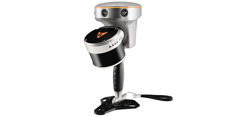
 Specialist land and property surveyors Formby Surveys has declared the ZEB1 mobile mapping system as a ‘game changer’! Following a trial of the world’s first truly mobile, hand held rapid laser mapping system, undertaken in partnership with 3D Laser Mapping, the Merseyside, UK, based precision measurement company reported significant time savings achieved in the scanning of existing buildings, compared to more traditional technologies and techniques.
“Once you understand the operating procedures ZEB1 ‘does exactly what it says on the tin’,” commented Managing Director Andy Roberts. “It’s simple, fast and offers excellent value for money; this makes it a potential ‘game changer’ on projects that are time or cost critical.”
Formby Surveys offer a precision measurement services portfolio providing a variety of professional sectors with land, property and specialist surveying services. With a reputation for utilising the latest technology and instrumentation to ensure complete ‘field to finish’ quality assurance procedures, Formby were keen to trial the ZEB1. The system was put through a rigorous field evaluation with a ZEB1 operating novice completing a scan of an old police station and court room in a matter of hours rather than days.
“Not only is the ZEB1 the right tool for the right job in some cases it is potentially the only tool,” continued Andy Roberts. “I can see it dramatically changing the way we undertake some projects giving us a crucial competitive edge.”
Developed by CSIRO and commercialised by UK based 3D Laser Mapping, ZEB1 uses robotic technology called Simultaneous Localisation and Mapping (SLAM). The ZEB1 system includes a lightweight laser scanner mounted on a simple spring mechanism, which continuously scans as the operator walks through the environment. As the scanner loosely oscillates about a spring, it produces a rotation that converts 2D laser measurements into 3D fields of view. Its ability to self-localise makes ZEB1 ideally suited for use indoors, underground and in other covered environments where traditional solutions that utilise GPS don’t function well.


