The lidar market was valued at USD 1.90 billion in 2018, and it is expected to reach a value of USD 3.89 billion by 2024 at a CAGR of 12.76%, during the forecast period. Over the years, advancements in lidar mapping systems and their enabling technologies penetrated into different verticals, like aerospace and defense, corridor mapping and topographical survey, automotive, mining, oil and gas, and other verticals, which are increasing the market scope of the lidar market.
LiDAR Market – Geographical Overview
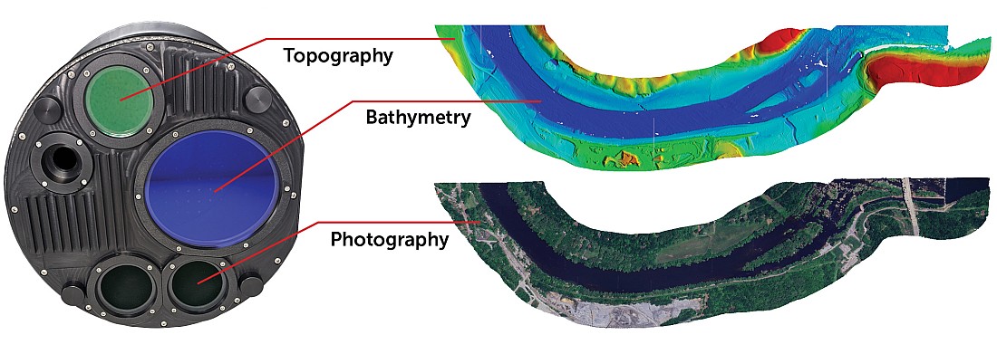
LIDAR, which stands for light detection and ranging, is a remote sensing method that uses light in the form of a pulsed laser to measure ranges (variable distances) to the Earth. Advancements in laser scanning, GPS, and bandwidth have allowed for new lidar applications, such as mobile lidar known for mobile laser scanning (MLS), which is used for mapping, engineering, and self-driving applications.
Highlights of the Market:
- The increasing use of drones, across various applications, such as aerospace and defense, agriculture and forestry, and natural resources management, among others, is expected to propel the industry’s growth. The delivery and automation sectors are the leading sectors that invest in drone research.
- Governments in different countries are using lidar technology for topographical surveys, mapping, surveillance, and monitoring in the mining and oil and gas sectors. Due to low cost and enhanced features, when compared to conventional alternatives, lidar is easily accessible for the government sectors.
- Rising demand for innovative 3D imaging technology throughout several areas of applications and growing adoption of aerial lidar systems to detect and explore various places and historical details are supporting the lidar market effectively.
- The ground-based lidar systems are expected to hold a major share in the market during the forecast period, owing to the key factors, such as low cost and increasing applications in SUV. Ground lidar possesses an exceptional ability to produce 3D images of land at coastal and other areas and ground movements, such as landslides, and it can be analyzed and measured by satellite imagery.
- Furthermore, EERI (Earthquake Engineering Research Institute), who partnered with GEER (Geotechnical Extreme Events Reconnaissance), can utilize ground-based lidar to collect damage morphology data at speeds, accuracies, and range that was previously unimaginable in the earthquake. Therefore, earth observation may significantly stimulate the market growth.
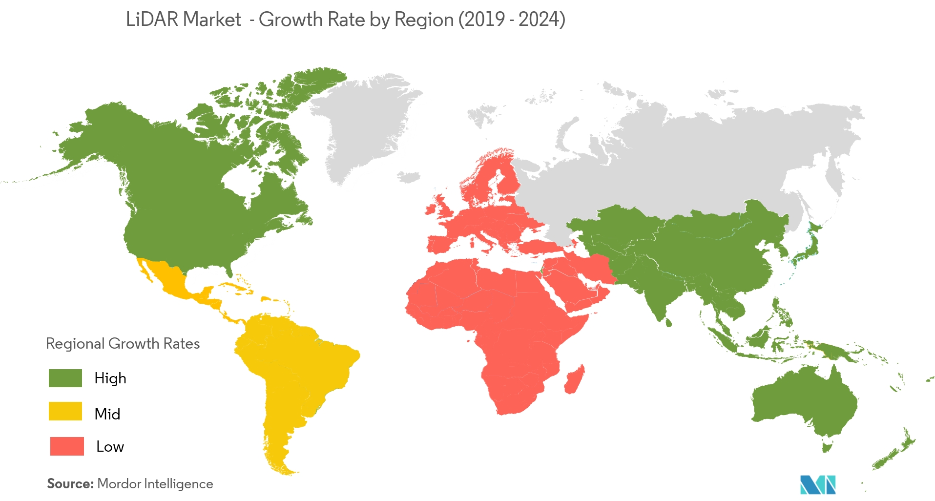
North America is Expected to Hold a Major Share in the Market
- North America is dominating the lidar market, owing to the rising demand for 3D imaging technology in the US and Canada. Additionally, the increased adoption of lidar in government agencies is further expected to fuel the market growth.
- The increasing investments of business giants in North America, such as General Motors, Google Inc., and Apple Inc., toward ADAS and driverless cars are providing new opportunities for small, versatile, and low-cost lidar systems.
- In addition, major companies in the market, such as Trimble, Faro, and Velodyne are based in the United States, which is another major factor for the large share of the North American market.
- Furthermore, the US defense industry has increased its military and defense spending, which has created opportunities for lidar to proliferate into the industry. Key players profiled include Quantum Spatial (Aerometric), Faro Technology, Geodigital, Trimble Navigation Limited, Leica Geosystems, etc.
Know more: LiDAR Market – Growth, Trends, and Forecasts.