The geo-information company presents ViSOR (Virtual Sensor Ordering Resource), a multi-mission analysis application where users can manage a satellite constellation, of which Deimos Imaging is a part.
The application, which includes more than 30 sensors, is a powerful interface to perform high quality feasibility studies and assists tailor-made satellite tasking requests of any area of interest, anywhere in the world, and allows the user to define and take control of where, when, and how to perform an acquisition.
Some of its main features and capabilities are the management of more than 30 satellites, an intuitive and interactive development of all of the operations performed by the user, and the management of the area of interest through the following options: import, export, editing, drawing and multi-polygon designs to define user’s own area of interest.
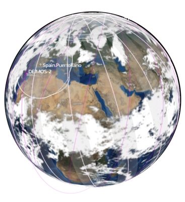
Besides, the application has an Earth Overview with various information layers; such as world maps, sensor swaths, ground stations coverage, satellites’ ground track, 3D/2D world projection, etc. and makes cloud forecasting provided by NOAA weather service, up to 16 days before the capture.
ViSOR also allows to perform opportunities analysis, gathering the best acquisitions according to user’s search parameters (capture’s editing & management based on customer needs) and area of interest studies: coverage & capture’s simulations, extremely useful to quantify time and resources that are invested in imaging campaigns and feasibility studies.
Another feature is the satellite tasking orders: requests & planning of new acquisitions from Deimos & its partners missions, as well as orders’ status & follow up: orders’ updates are available anytime, from acquisition planning till product delivery.
If you need further information please contact at media@deimos-imaging.com.