News - Remote Sensing
Golden Software releases new version of scientific graphing package Grapher
News
News - GNSS and Positioning
Hexagon presents simple solutions for construction
News - Geoprocessing and GIS
Esri to Enhance Its Platform Capabilities with Infogroup Data
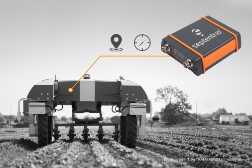
News - GNSS and Positioning
International Lidar Mapping Forum Announces New Keynotes: Jack Dangermond and Geospatial Executives Panel
News - Remote Sensing
SimActive Speeds Up Stockpile Measurement with Drones
News - Remote Sensing
GNSS heading just got more efficient with Septentrio’s AsteRx SB ProDirect
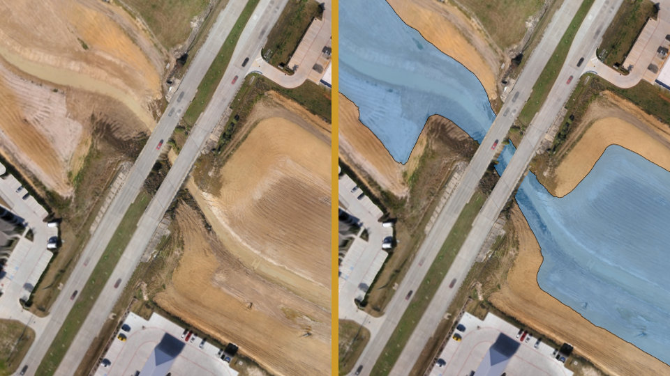
News - GNSS and Positioning
Virtual Surveyor Streamlines Volumetric Calculations for Stormwater Retention Ponds, Basins & Quarries
News - Remote Sensing
Land Info Announces 5G Wireless Mapping Team in Europe
News - GNSS and Positioning
Aero Photo Europe Investigation first to purchase Leica CityMapper-2
News - Geoprocessing and GIS
URISA Announces 2019 Young Professional of the Year
News - GNSS and Positioning
Leica Geosystems brings the world’s first MultiStation to the next level
News - Geoprocessing and GIS
New version of 3D streaming community standard, I3S, adopted and published by OGC
Editorials
Live Schedule


