Drones and Robotics More than 12,000 professionals attended the MundoGEO Connect, DroneShow Robotics, SpaceBR Show, and Expo eVTOL 2026 exhibitions
eVTOL Eve Completes Hover & Low-Speed Flights Block, Advancing eVTOL Toward Transition Flight Testing
Geospatial Technologies A Continent of Precision: How to Meet Europe’s Demanding Spatial Data Standards?
Geospatial Technologies Trimble Technology Enables First Centimeter-Accurate 3D Model of Disappearing Puncak Jaya Glaciers
Space EUSI Upgrades German Ground Segment to Enable Europe’s Fastest Request-to-Receive Satellite Intelligence
Geospatial Technologies Dephos Group is launching the Portuguese version of the Limon software worldwide during MundoGEO 2026
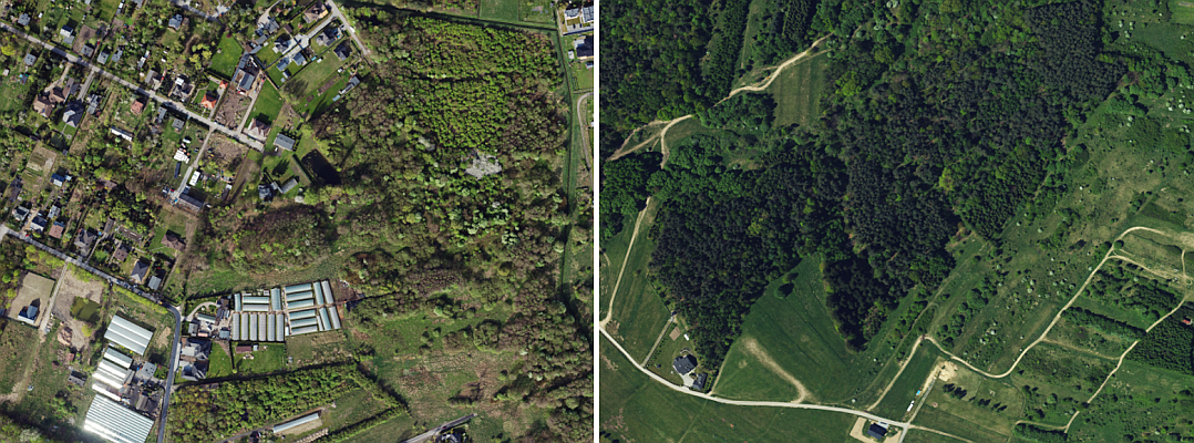
Geospatial Technologies Aerial image quality control at machine speed: how synthetic defects solved the rare-error problem
Geospatial Technologies Geospatial Data: The Foundation for Becoming a Partner for the Agricultural Insurance Market
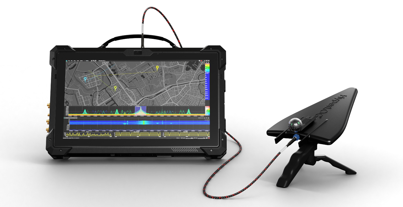
Drones and Robotics Aaronia AG Presents State-of-the-Art Solutions for Real-Time Signal Classification, Direction Finding, and Drone Detection
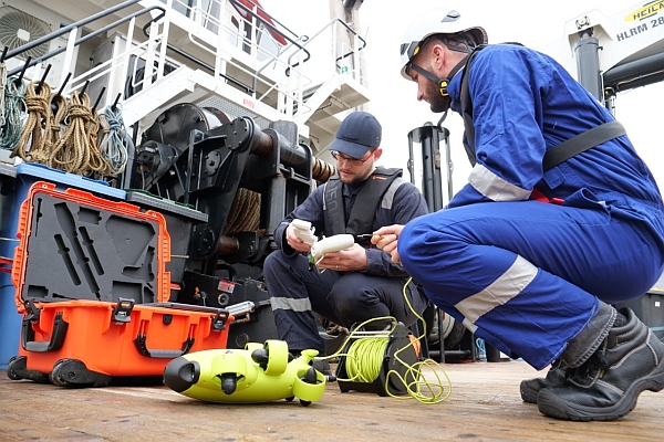
Drones and Robotics Ned Marine launches flying drone and subsea ROV inspection services for Non-Destructive Testing
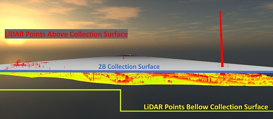
Geospatial Technologies Tech Talk on UltraMap & UltraCam Merlin: A perfect combination for efficient data production