eVTOL Eve and Helisul announce partnership to develop UAM products and services in Brazil with order of up to 50 eVTOLs
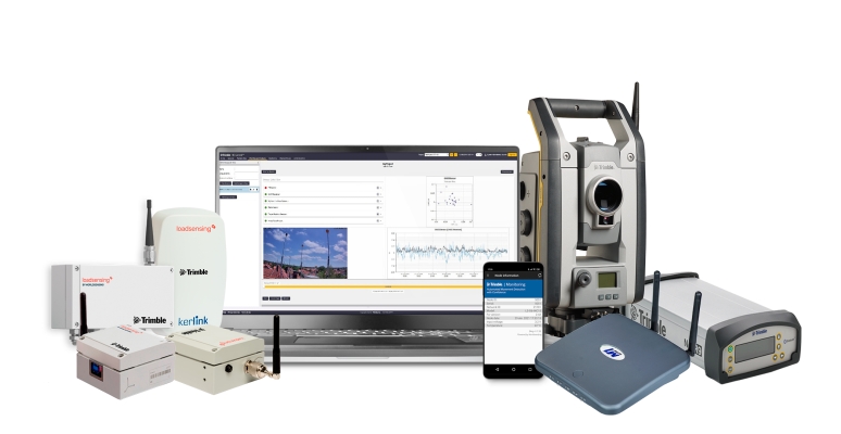
Geospatial Technologies Trimble Expands its Geospatial Automated Monitoring Portfolio with Worldsensing Geotechnical IoT Solutions
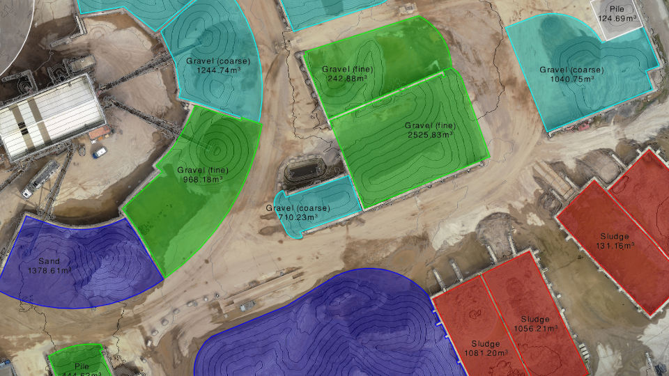
Geospatial Technologies Virtual Surveyor Introduces Enhanced Stockpile Reporting in Drone Surveying Software
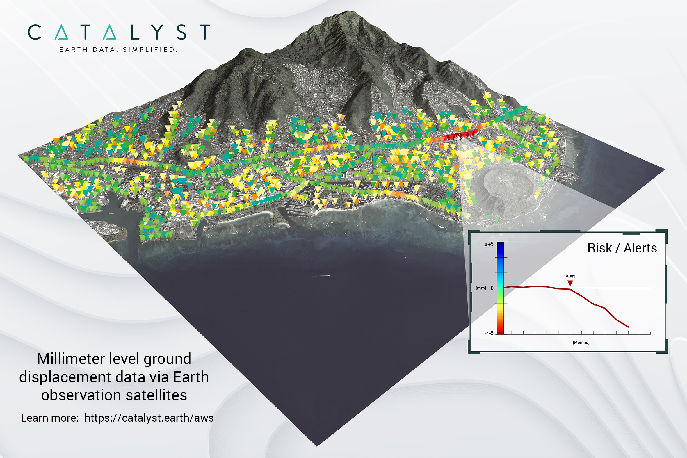
Geospatial Technologies CATALYST Collaborates with Amazon Web Services to Deliver Geospatial Insights to Decision Makers
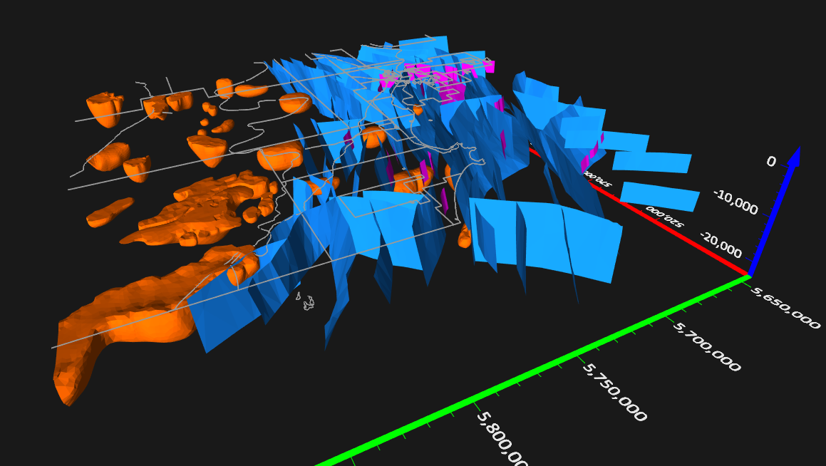
News - GNSS and Positioning Golden Software Enhances 3D Functionality in Surfer Surface Mapping Package
Geospatial Technologies Introducing NavVis IVION Core, a reality capture platform that adds more value to buildings and assets
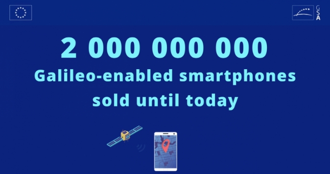
Geospatial Technologies Smartphone users put their trust in Galileo with 2 billion Galileo-enabled devices sold